Despite the devastation, this is still a beautiful place and the conifers remaining attract specialty forest birds.
 |
| From Stonewall Mine looking south across the meadow. |
 |
| Stonewall Mine is 1 mile south of Lake Cuyamaca, roughly a dozen miles midway between Julian and Descanso. |
 |
| Stonewall Mine trail map |
A is the parking lot at Stonewall Mine.
B Trout Pond Trailhead (there is no trout pond) parking lot for Los Vaqueros Trail to Marty Minshall Trail.
C Fletcher Island.
First, some tactical information. Free public restrooms are sparse. The one at Stonewall Mine seems perpetually closed, but perhaps is only open in summer when I visit less frequently. There are porta-potties on Fletcher Island. Pay private campgrounds and day use areas are on the west and north side of the lake. Paso Picacho campground is 1 mile south on Hwy 79.
For a quick birding stop, many birders restrict their birding to the top of the hill right around the Stonewall Mine parking area (A). The Jeffrey Pines are largest here. Expect montane forest species such as Steller's Jays, Mountain Chickadees, and Pygmy Nuthatches (more common here than on Palomar Mountain). Hairy Woodpeckers, Red-breasted Sapsuckers, and Purple Finches are rare residents. On the other hand, the black oak-loving species are equally or more common: California Scrub-Jays, Oak Titmouses, White-breasted Nuthatches, Acorn and Nuttall's Woodpeckers, House Finches.
Spring and summer bring neo-tropical migrants and summer residents: Western Wood-Pewee, Pacific-slope Flycatcher, As-throated Flycatcher, Western Kingbird, House Wren, Black-throated Gray Warbler, Townsend's Warbler, Hermit Warbler, Wilson's Warbler, Western Tanager, Black-headed Grosbeak, and Bullock's Oriole are the more common of many additional summer visitors or residents. Lower elevations nearer the lake are frequented by Wild Turkeys.
The eBird Hotspot list for Stonewall Mine combines both the pine forest and the lake. You'll have to use your knowledge of birds in wet habitats versus dry pine forest to know where to expect them. So I'll describe two separate hikes of a couple hours each, that also combines forest and lakeshore.
 |
| This should be called the Mobius Loop Trail. If you get lost, take the horse trail sign you see behind. |
The Stonewall Mine parking area (A) is near the summit of the hill. There are several loop trails around the hill. Thus, following the trails down and around is where there is the most elevation change (though only a couple hundred feet). A hike around the loop trails and over to and around Fletcher Island is about 2.5 miles round trip, though could be shorter if you take a more direct route and skip some of the loops (see map above).
The top of the hill is more pure conifer forest, while more black oaks mix with conifers on the lower flanks. The forest is very open with little understory--mostly just grass between widely spaced trees. When approaching Fletcher Island you leave the Cuyamaca Rancho State Park lands at a footbridge to the island. You may also see a sign that warns of hunting on certain days of the week in fall and winter. This doesn't mean you can't visit on those days, it is just to let you know that duck hunting takes place around the lake in early morning. You may want to delay visiting the lakeshore on these days until a couple of hours after sunrise.
The Fletcher Island loop (C) gets you next to the low rock dam on the NE end of the lake. Water is deepest next to the dam so some diving ducks or grebes may concentrate here. Behind the dam there is an intermittent marsh in winter that may have herons or other water birds, and perhaps hawks hunting over the grassy plain. Bald Eagle is a frequent visitor. From Fletcher Island you can see larger ducks and geese on most of the lake, though smaller shorebirds on the far shores will be too distant to see or identify.
 |
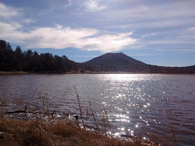
| Lake Cuyamaca looking south from Fletcher Island. |
An out-and-back hike from the Trout Pond Trailhead (again, there is no Trout Pond trail... I guess all the good names were taken) may be best for spring migrants in the riparian willows and fall shorebirds on the shallow south end of the lake. From the parking area (B) head north to the southeastern corner of Lake Cuyamaca. This may be the best location to find Wild Turkeys, though you are likely to see them in some of the rural yards and pastures on your drive here on Hwy 79.
You may continue to the bridge to Fletcher Island (C) and turn back there, for a total of about 2 miles, or continue around the island, adding another 1/2 mile. Or you an turn into the Stonewall Mine trails through the pines.
Fishing paths and trails actually circle Lake Cuyamaca. If you are so inclined you may hike all the way around the lake, or so I'm led to believe. It is supposed to be 3 miles around the lake, and perhaps 5 miles hiking around Fletcher Island and back tracking to the Trout Pond Trailhead.
There is actually a decent restaurant on the west shore of lake. It serves breakfast and lunch.
 |
| Oak Titmouses are restricted to... oaks. |
 |
| Acorn Woodpeckers are abundant in pine-oak woods. |
 |
| Pygmy Nuthatch. More common here than at Palomar Mountain. |
 |
| Ruby-crowned Kinglet is fairy common in winter throughout San Diego. |
 |
| Mountain Chickadee is fairly common in pine and mixed woods. |
 |
| White-breasted Nuthatch is fairly common in pine-oak woodlands. |

No comments:
Post a Comment
I really want to hear from you! I've changed settings (again) in order to try to make commenting easier without opening it up to spammers. Please note, however, that comments to posts older than 14 days will be moderated. Thank you.