Pages

Sunday, September 29, 2019

Site Guide: Orosco Ridge Trailhead and Pamo Valley, Ramona

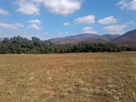
North of Ramona is Pamo Valley. It is a lovely pastoral valley in the inland of San Diego's North County. The grassland is surrounded by steep chaparral-covered hills. Santa Ysabel Creek is dry for much of the year. The riparian trees include mature live oak, sycamore, cottonwoods. Cattle graze in the open range of a ranch that dates back to the 1860s. Wild Turkeys rest in the shade under the oak trees.

In previous years local birders would slowly drive the 5-mile dead end dirt road to look for unusual winter birds. These include Mountain Bluebirds and Lewis's Woodpeckers nearly every year. Golden Eagles are rare, but regular. Western Kingbirds are common in summer. But, frankly, there have been very few birders visiting here except from late December through January. But still not very many at all. Many birding hotspots in San Diego record more birding visits in one day than the total of all eBird checklists ever entered for Pamo Valley.

eBird bar chart for Pamo Valley Hotspot here.

But things have changed recently and there is a decent location now to hike around and visit oak grasslands, coastal sage scrub, and riparian sycamore and cottonwood.

A new 3-mile trail was added in January 2019 to the San Dieguito River Park Coast to Crest Trail. It now connects the Lower Santa Ysabel Truck Trail with the Upper Santa Ysabel Truck Trail along side Pamo Road. Those two trails, plus the new connector trail along Pamo Road create a 12-mile trail section. Most birders will not hike this trail.

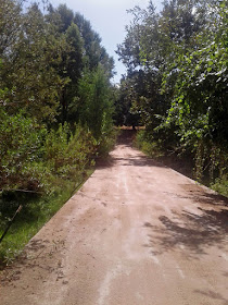
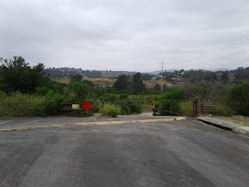
Instead, there is a new trailhead parking area at a lush section of the Santa Ysabel Creek.

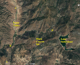
Pamo Valley map

Getting there: Travel to Ramona via Hwy 78 through Escondido and past the San Diego Zoo Wild Animal Park. Or you can go on the very curvy Highland Valley Road past birding hotspots of the Ramona Grasslands Preserve and Rangeland Road. From San Diego the less curvy route of about 40 miles is to take CA-163 north and then I-15 north to Exit 17, Mercy Road for Scripps Poway Parkway. Then take CA-67 into Ramona. Left on 7th, right on Elm, right on Haverford until it curves left (to the north) and becomes Pamo Road.
Parking: Free.
Hours: Daylight.
Restrooms: Porta-potty.
Map navigation: Orosco Ridge Trailhead, Forest Rte 12S04, Ramona, CA 92065

Pamo Valley map

Where to bird: Driving Pamo Road

Birding here generally starts on Pamo Road just as you pass the landfill (A on the map above). From here Pamo Road descends a rather steep grade of more than a mile. There always seems to be interesting raptors and other birds, but no real place to pull over and stop.

At the bottom of the grade you come to the new Orosco Ridge Trailhead parking area (B on map). From here it is just over 4 miles to the end of the public road at a ranch house (C on the map). Driving this section of road and pulling over to view birds used to be the only birding here. And it still is enjoyable. But we'll go back to B and spend time there after I first tell you about other areas on the map above.

I have driven Pamo Road in April at night and recorded Western Screech-Owl, Great Horned Owl, and Common Poorwill.

Nearby at Black Canyon Road:

As you leave Ramona via CA-78 on the north end of town you can turn north on Magnolia Street, which becomes Black Canyon Road. This is another little valley, but dry chaparral. In spring it has Bell's Sparrows and similar birds. There is a riparian area to park at the old Black Canyon Bridge (D on the map). I wrote a site guide several years ago to Black Canyon Road. You can drive from Black Canyon Road to Lake Sutherland and back to Ramona and CA-78 via Sutherland Dam Road.

I have driven north 14 miles from Black Canyon bridge (D) to Lake Henshaw via Mesa Grande.

You can hike from Pamo Valley to Black Canyon Road (B to D) but you cannot drive easily between the two valleys.

Where to bird: Orosco Ridge Trailhead

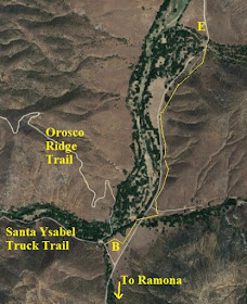
Okay, back to the Orosco Ridge Trailhead (B on the map above and below).

Pamo Valley map

The new trail parallels Pamo Road. The first 1.25 miles of trail (highlighted with thin yellow line above) crosses riparian zones twice. It would be good for roadside and grassland birds. At each of the little creek crossings there will be Oak Titmouses, Spotted Towhees, Acorn Woodpeckers, American Kestrels, Western Bluebirds.

But walking down into the riparian from the trailhead is likely to be most productive. In my short visit at noon in September 2019 I found House Wrens, Nuttall's Woodpeckers, Lesser Goldfinches, Spotted Towhee, a Red-shouldered Hawk, Western Wood-Pewee. I heard Wrentits. I walked a short distance up the Orosco Ridge trail--to the second hairpin turn--where a pair of Rock Wrens were flitting about in the hillside.

The creek bottom was dry and the lush grass amid the trees was cut short by cows that graze there. A group of Wild Turkeys eyed me warily. I think this area could be quite productive in spring. I would just walk at the edges of the stream bottom, as I assume the ground would be damp in spring.

I think that it may also be interesting to walk a ways down the riparian along the Santa Ysabel Truck Trail. I imagine that chaparral sparrows would be good in April, and neotropical migrants would be good in May.

Pamo Valley is a pleasant place to watch roadside birds. Now there's even more opportunities to visit with some walking into the oak and riparian creek bottom that hasn't been available until recently.

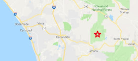
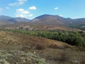
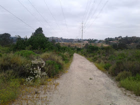
Photo of Orosco Ridge Trailhead, Pamo Valley

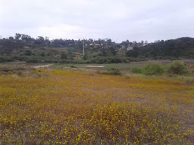
Photo of Orosco Ridge Trailhead, Pamo Valley

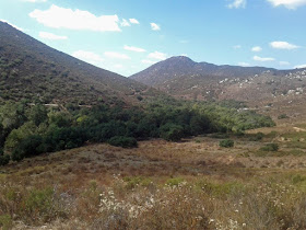
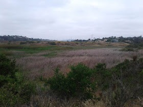
Photo of Orosco Ridge Trailhead, Pamo Valley

Photo of Orosco Ridge Trailhead, Pamo Valley

Friday, September 27, 2019

Site Guide: Stonebridge Trail, Solana Beach

Upstream 2 miles from the ocean at the mouth of the San Elijo Lagoon in Solano Beach is the Stonebridge Trail. It is one of several short trails in the area that can be good for birds in the river bottom. In winter and spring there may be water to block full access to some of the trails, but it is fairly dry during most of the year.

There are two species in spring that are hard to find in San Diego County that may be found here: Solitary Sandpiper which migrates through from mid April to early May, and American Bittern which may winter or breed. The wetlands and small ponds with mudflats can have other surprises in spring, which is when most birders visit.

You may also want to look at this site guide I wrote to the nearby San Elijo Lagoon.

Getting there: Travel 17 miles north on I-5 from the I-8 interchange. Take Exit 37 for Lomas Santa Fe Drive. Parking: Free street parking at the end of Santa Helena. Hours: Daylight hours. Restrooms: None. Map navigation: 982 Santa Helena, Solana Beach, California.

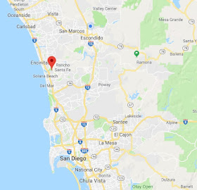
Map showing location of Solana Beach and San Diego area

Stonebridge and La Orilla Trail maps (see text). Click to enlarge.

Where to bird:

A) Parking at Santa Helena
B) Stonebridge Mesa
C) Parking at Santa Carina
D) Parking at Santa Inez
F) Parking at El Camino Real

Park at the end of Santa Helena and begin the trail (A on map). It leads north under power lines through coastal sage scrub habitat.

Photo of view from Stonebridge Trail
Start of trail (A on map) looking north toward grassy Stonebridge Mesa in middle distance.

This first part of the trail has California Quail, California Thrasher, California Towhee, California Gnatcatcher, California Scrub-Jay. Also there will be other chaparral species such as Anna's and Allen's Hummingbirds, Wrentit, Bewick's Wren, and Spotted Towhees.

Photo of view from Stonebridge Trail
The trail begins under the power lines, looking north.
After about 1000 feet you meet up with the La Orilla Trail intersection. Here you will encounter the riparian willows and shrubby trees. In spring you will find Yellow-breasted Chats, Black-headed Grosbeaks, Common Yellowthroats, Orange-crowned Warblers, Brown-headed Cowbirds, and Red-winged Blackbirds.

Continuing north you cross marshy grass. If it has rained recently you may not be able to pass the mud. Otherwise, continue north and start up the Stonebridge Mesa and head toward B on the map. On the Mesa trail you can look down on some ponds at B on the map. You may find Black-necked Stilts, American Avocets, Greater Yellowlegs, and other shorebirds in spring and fall. A scope may be beneficial for scrutinizing shorebirds. You may carefully scan the pond edges for the occasional Solitary Sandpiper from mid-April to mid-May, and then again in September-October if water remains.

The mesa also allows you to hear birds below. Listen for Virginia and Sora rails, Marsh Wrens, and other birds. You may hear Least Bitterns. This is one of the few reliable places to hear American Bitterns in the county.

Photo of view from Stonebridge Trail
View from Stonebridge Mesa (B on map) looking south back to parking area (A)
You've now walked about 3000 feet, almost 3/4 of a mile. It's about 1.25 miles round trip from the parking area out and around the Stonebridge Mesa and back to the car. If I have additional time I sometimes go back to the Orilla Trail and head westward on the trail, skirting more wet marshes, toward C on the map. Then I head back.

Photo of view from Stonebridge Trail
Looking north toward Stonebridge Mesa from La Orilla Trail between A and C on map.
I've also done some birding from the trailheads from Santa Carina and Santa Inez. I haven't found it to be as productive. The freeway noise can be overwhelming--at least, for trying to hear birds.

There is a dike at Santa Inez that is now closed due to construction. If I understand the signage it may remain closed in the future. When I walked it when it was open I thought maybe it would lead out into mudflats and shorebirds. But it was barren. If it ever opens again I still think it could be productive for shorebird migration, depending upon the tides and recent rains.

The main parking for the La Orilla trail is on El Camino Real (F on the map). Birders are as likely to access Stonebridge Mesa from this trailhead as from the Santa Helena access. I've never parked there and walked that section of trail, but I intend to eventually. From El Camino Real to I-5, the San Diego Freeway near Sana Inez it is about 1.5 miles.

eBird lists hotspots:
San Elijo Lagoon--east: 197 species  (480 checklists--more generic location)
San Elijo Lagoon--Stonebridge Trail: 159 species  (151 checklists)
San Elijo Lagoon--La Orilla Trail: 156 species  (223 checklists)

Combined: 209 species
Here is a bar chart from eBird with weekly sightings.

Here are some of my bird photos from Stonebridge Trail.

Photo of California Quail at Stonebridge Trail
California Quail. June 14, 2019.
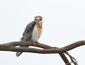
Photo of White-tailed Kite at Stonebridge Trail
Juvenile White-tailed Kite. June 14, 2019.
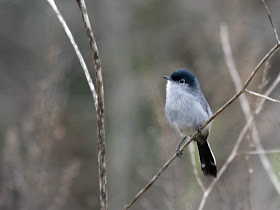
Photo of California Gnatcatcher at Stonebridge Trail
California Gnatcatcher. April 25, 2018.

Sunday, August 25, 2019

A private pelagic trip

I organized and led over 160 pelagic trips from Oregon in 20 years starting in 1994. Recently, I heard from a former regular passenger, Kit, that she was visiting her son in San Diego. Kit's son has a boat and she wanted me to plot out a course and help with bird ID. And she invited Marlene to come with me. Sounds like fun!

So it was I found myself aboard the vessel Reel Science on July 21.

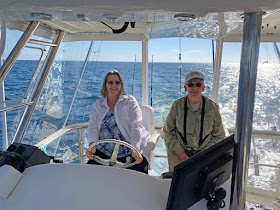
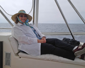
Marlene and Kit
Marlene (left) and Kit (right) on the flying bridge.
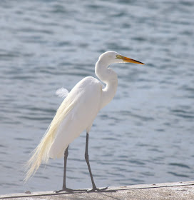
We got a fairly late start, with some family and friends arriving later than others. By 9:00 am, though, we were underway and looking at birds on the bait docks. That included this Great Egret.

Great Egret

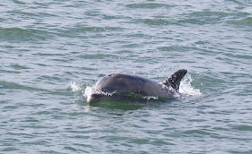
We escorted through the bay by a Bottlenose Dolphin.

Bottlenose Dolphin

As we were going out, the aircraft carrier Nimitz was coming in!

Aircraft carrier Nimitz

Just offshore, we passed the USS San Diego.

USS San Diego

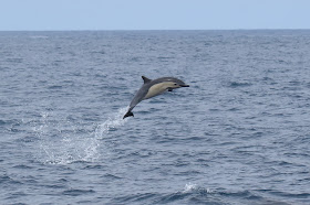
Nearing the Nine Mile Bank we found a large pod of Common Dolphins. This one made quite an impressive leap!

Common Dolphin leaps from the water

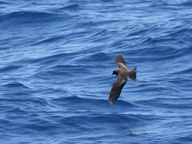
Soon we spotted Black Storm-Petrels. This is one of my better shots of this bird that doesn't approach too near the boats.

Black Storm-Petrel

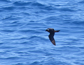
Another view.

Black Storm-Petrel

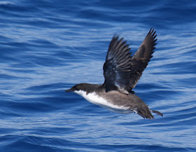
The dark under wing linings of this black-and-white murrelet confirm its identity as Craveri's Murrelet.

Craveri's Murrelet takes flight

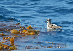
There were many small patches of kelp paddies floating offshore. Nearly each one had an accompaniment of Red-necked Phalaropes, just back from nesting in the Arctic.

Red-necked Phalarope on kelp paddy

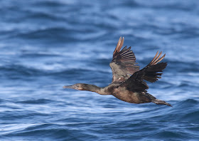
Closer to shore a Brandt's Cormorant flew near the boat.

Brandt's Cormorant

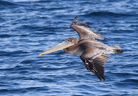
Brown Pelicans were also common near shore and in the bay.

Brown Pelican

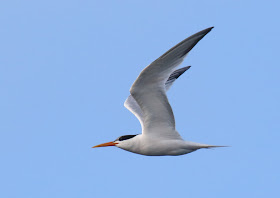
Elegant Terns were our companions throughout the trip.

Elegant Tern
Marlene
Marlene found a comfortable perch to enjoy her day at sea.
Point Loma
Passing out San Diego Bay in the morning always starts with a view of Point Loma
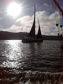
sailboat
Sailboat silhouette
Sail boats in San Diego Bay
What a fun day. Thanks Kit!

Thursday, August 1, 2019

What are the best camera settings for pelagic bird photography?

On my Canon EOS 7D with Canon EF 100-400mm 4.5-5.6 IS lens, these are the camera settings I start with at the beginning of the pelagic birding trip: Manual mode, shutter speed of 1/1250, an aperture of f/7.1, exposure compensation of plus one full stop, Continuous focus mode called AI servo, Auto ISO, Evaluative metering, and autofocus mode to 1 point AF. Of course, all my bird and wildlife photography uses RAW format and Automatic White Balance.

Over the years I've struggled to find the best camera settings for pelagic bird photography. I've finally settled on what works best for me for photographing birds from a boat at sea. Those are listed above. Now I'll tell you why I like them. I also found some recommendations from others that I'll share when they are different from my settings. Then I'll give you a great tip I received that helps me instantly dial in all the correct settings.

Note: This post assumes intermediate or advanced knowledge cameras and photography in general, and rather intimate knowledge of the settings and menus on your personal DLSR camera with telephoto lens. Your camera's user manual is your friend.

The reasons for my settings

Every camera/lens combination is unique. I have the older Canon 100-400 lens. It is a bit soft in focus when it is wide open. It takes sharper photos when the aperture is 7.1 or higher. The image stabilization will let me take hand-held photos down to 1/400 of a second or slower. Sometimes. But I find that 1/640 is as slow as I should go with a stationary bird, hand-held, on land. On a boat? Better get it up to 1/800 or higher. 1/1250 seems ideal for most of my photography. For fast-flapping birds, 1/2400 will freeze most wings. But I want to keep ISO to 1000 or under. The closer to ISO 100 the clearer and sharper will be my photos.


Friday, July 19, 2019

A family of White-tailed Kites at San Elijo Lagoon

While visiting Stonebridge Trail upstream from San Elijo Lagoon, I came across a tree with 5 juvenile kites! I photographed two that were out in the open a bit more.

It was an overcast morning so I increased the exposure compensation 1 full step, even though I was using spot metering.

Juvenile White-tailed Kite
Juvenile White-tailed Kite. San Elijo Lagoon, California. June 14, 2019. Greg Gillson.

Tuesday, July 16, 2019

California Quail at San Elijo Lagoon

Here's a recent photo. Well, it's a month old now, I guess. What can I say, I've been busy.

California Quail
California Quail
California Quail. San Elijo Lagoon, California. June 14, 2009. Greg Gillson.

Monday, July 8, 2019

Stalking Birds: 25 tips: How to get close to birds without scaring them away

In my previous post I discussed whether it was really necessary to get closer to a bird. In some cases, to protect the welfare of the bird, it may be best not to approach closer. Likewise, if other people are desiring to see the bird, it would be rude to scare it off so that others couldn't enjoy it. And you don't want to harass birds, or give the impression that you are to onlookers.

You can learn to approach birds more closely without frightening them. Then again, you can remain still and have the birds come to you! Both these outcomes start with the same premise: Don't look threatening.

Approaching birds

Perhaps you have noticed in a park that some birds habituated to people remain only a few feet off the trail as bicyclists, hikers, and even dog walkers pass by. Yet you don't get as close as they did and don't even get your binoculars raised before the bird flies off! Why?

Think about it from the bird's perspective. People pass by all day, most paying them no attention. They are not a threat. Yet here come you, straight at the bird. Not only that, you are staring at the bird with these large unblinking glass eyes. Threat!

So your first fieldcraft tip is (#1) not to approach a bird directly. Make as if to pass the bird by. Meander. Curve your path gradually toward the bird. Don't stare at the bird while moving toward it. Look away. Watch it out the corner of your eye until you are closer. Then stop.

Next, (#2) as you approach carry your binoculars or camera up to your face. Birds are often spooked by arms raising suddenly or pointing. Rest your optics on your cheek as you approach, then slowly tilt your optics to your eyes.

Third, (#3) watch your step! Don't break a twig or scrape the gravel. A sudden noise and off they fly! Move slowly and steadily.

Watch the bird. (#4) Is it alert and watching you? Stop. Let it get used to you and get back to whatever it was doing before you showed up. Is it fidgeting? Twitching its wing? Standing up straighter? Nervously scratching? Raising the tail? It may already be too late. Back off. Wait. If the bird is comfortable singing, feeding, and just being a bird while you take photos, then you are the correct distance.

Diving water bird tip ("Dive and Dash") (#5): Diving ducks, loons, grebes--wait for the bird to dive. Count how long the bird stays down. Next time it dives, run forward, crouch down. Wait for it to resurface. It may move closer. If it resurfaces farther out and facing away, you've been spotted. It won't return.

Singing bird tip (#6): Singing males are more easily approached during the time they are belting out their song. In between phrases is when they fly. If they are singing you may be better off walking forward at that time. Avoid over-pursuing singing birds during this sensitive breeding season time.

Blue Grosbeak
Territorial Blue Grosbeak.
Auto tour tip (#7): Some refuges and nature reserves may have auto tour routes. Even some country roads with wide shoulders along fields or wetlands may have bird viewing and photography opportunities from inside your car.

Saturday, July 6, 2019

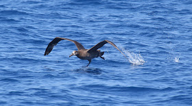
Black-footed Albatross off San Diego

After 9 hours our pelagic trip was nearly over, and we were heading back toward port. We were still about 15 miles offshore, though, when the call of "Albatross!" went up. And there it was: far behind the boat but closing on our stern.

We were still trailing some popcorn and had a flock of gulls behind the boat. The albatross must have thought we had something good to eat. Well, albatrosses like popcorn just fine, though they'd probably rather have their favorite food--squid!

Albatrosses are fairly rare off San Diego. Trips in April, May, and June frequently will record one. They are sometimes found in August, but generally not later.

Black-footed Albatross
Black-footed Albatross. Off San Diego. June 9, 2019.


Thursday, July 4, 2019

Scripps's Murrelets off San Diego

Birds on the water!

Two dark dots, sitting on the water ahead: murrelets!

Murrelets are "always" in pairs. They swim together, dive together, fly together. A singleton is rare. Three together is also quite unusual.

Now will they stay there long enough for the boat to approach more closely? If not, then they may get away unidentified further.

We are 15 miles offshore from San Diego, following the Mexican border westward. The water has been getting gradually deeper as we progress, but then became quite shallow again as we crossed over the south end of the Nine Mile Bank. Birds increased as the underwater hill forced bottom currents to the surface, carrying nutrients toward the surface that fish feed upon. Birds followed.

Monday, July 1, 2019

Fieldcraft: Stalking Birds: Do you really need to get close?

Eyeball to eyeball with Greater Roadrunner
Back off buster!
Before I post the techniques for approaching birds closely, I must ask the question: "Do you really need to get closer to the bird?" Let's discuss two reasons not to approach the bird more closely.

Today's optics are good enough that you can happily observe a bird from a distance that does not disturb it. Therefore, I can only assume that if you want to get even closer to a bird, you probably are trying to photograph it.

If you can approach closely, take your photographs, then back away--without the bird flying--then you have been successful. If the bird flies, you've failed; you have disturbed it. Once you flush a bird it is not going to let you get that close again. There's no sense chasing after it. You had your chance, but it's over. Move on. Any further stalking becomes harassment.

Monday, June 24, 2019

A final 10 common backyard birds in San Diego

This series started with The 10 most common backyard birds of San Diego, California. It was followed by Another 10 common backyard birds of San Diego.

Here, then, are a final 10 common birds you will likely be able to find in your backyard. Of course, depending upon what trees and plants you have, what habitats border your home, and exactly where you live, many more are possible--especially during spring and fall migration. And if you include the airspace above your home, then you may spot even more as they fly over. But these final ten are likely in most backyards within the region.

Combined with the previous 20 species, these 30 total common birds will provide the beginner with a manageable starting point for learning the backyard birds of San Diego and, indeed, most of southern California.

So let's get right to it. Here are more birds to find in your backyard in the San Diego region.


21) European Starling

European Starling
Adult European Starling. Escondido, California. January 14, 2018.
European Starling
Juvenile European Starling. Forest Grove, Oregon. August 18, 2007.
Introduced to North America in the late 19th century, European Starlings are pretty much resident across North America from southern Canada to northern Mexico in rural and urban areas. Because of their aggressive behavior most birders do not want starlings in their backyards. Don't feed birds human food scraps and you likely won't have many European Starlings. Otherwise they may take over your feeders.


22) White-crowned Sparrow

White-crowned Sparrow
Adult White-crowned Sparrow. Poway, California. April 8, 2018.
White-crowned Sparrow
Immature White-crowned Sparrow. Lake Hodges, California. December 14, 2014.
White-crowned Sparrows from northern areas are common from October to April in southern California. They should come to your tray feeders or feed on the ground under them. They sing a cheerful series of notes and trills in late winter and on their northward journey in spring to their breeding grounds.

Thursday, June 20, 2019

Black Skimmer at the San Diego River mouth

Black Skimmer
Black Skimmer. Mission Beach, California. June 1, 2019.
A flock of about a dozen Black Skimmers were feeding in the San Diego River mouth on June 1st, where I was able to get these flight shots.

To fly low and plow the shallow, calm waters with their knife-like bills, skimmers flap from horizontal to highly vertical, not below the horizontal in this feeding flight. The flock feeding flight appears choreographed and synchronized at times (upper photo). At other times flocks appear uncoordinated and chaotic (photos below).

Black Skimmer

Black Skimmer

Black Skimmer