Friday, May 27, 2016

Birding Cuyamaca Peak (south)

Two point seven miles. It is 2.7 miles from the parking lot of Paso Picacho Campground to the summit of Cuyamaca Peak. It doesn't sound that far, but it is continuously uphill. The elevation goes from 4880' to 6512'. Let's see, that's 1632 feet of elevation change in 14,256 linear feet. That's an 11.4% grade, right? No wonder my feet, knees, legs, and hips hurt!

I just got back from hiking the trail this morning (May 15, 2016). I arrived in drizzly fog and 47F at 6:00 AM. It was a warmer 62F and sunny when I returned to my vehicle about 11:00 AM to rush home to Escondido. I've got lots of photos to share, and maps to create, so I won't actually publish this for 2 more weeks.

The Campground and the Peak are in Cuyamaca Rancho State Park south of Lake Cuyamaca. This is 11.7 miles south of Julian on Hwy 79. It is also almost the same mileage north of Descanso on Hwy 79 at the intersection of Interstate 8.


The campground was spared from the October 2003 Cedar Fire. Not so, the 3 peaks of the Cuyamacas--North, Middle, South. There is a little swale of trees that was spared on the South Cuyamaca Peak. Otherwise, the once impressive forests of Oak, Incense Cedar, Coulter Pine, and other conifers were incinerated.

The south peak of the Cuyamacas is the second highest mountain in San Diego County. At 6512' it is only 20 feet shorter than Hot Springs Mountain near Warner Springs. It is supposed to have much easier access. I don't know about that. I drove up Hot Springs Mountain in my Kia Soul in April 2014. Not that I should have, mind you, but I did. Then I hiked only a mile through the forest on rather level roads up top.

The advantage of Cuyamaca Peak is that the highway is paved all the way to the Paso Picacho Campground. And the "trail" to the top, though almost 3 miles, is paved. Yes, there is a radio/microwave relay on top and the single-lane fire road is steep but paved. I just wish that someone could walk the first mile-and-a-half of the trail for me, because the birds I want to see are on the upper half!

So, I checked out The Hiking Guy web site. He has this hike listed as 6 miles round trip. Yep, that's right. And he has the hike as 2.5 hours. No, no, not so much. Of course, I was searching for birds to identify and photograph. It took me 3 hours to reach the summit, and another hour-and-forty-five minutes to return without too many diversions. Five hours. It took me 5 hours. And I feel like I rushed. If I ever attempt this again, I will make sure to spend the entire day to search more off-trail and wait patiently for birds to photograph.


eBird lists. Nearly all birders in the past seem to have combined their bird sightings for the entire hike. Then they generally placed their list marker either in the campground or on the summit. So, for birders wanting to plan a visit, the bird list is enticing, but useless to find the exact location of several rare and local birds.

So, on this trip I divided my hike into 7 lists between 8 points, as per the map above. And I included exact numbers. This way you may be able to know where on the hike I saw each species. Then you can plan a personal killer hike for yourself!

Target species are nesting Green-tailed Towhees, Thick-billed Fox Sparrows, and Dusky Flycatchers. All are very local as breeders in the County. This used to be a reliable spot to find White-headed Woodpeckers, but since the 2003 conflagration, only a couple have been noted. And as I mentioned, the eBird lists are poor for determining exactly where, though there are only pines near the peak and campground.

Most common species: Acorn Woodpecker (campground), House Wren (every one of my individual checklist locations), Spotted Towhee.

Use the map above to plan your hike on the paved Lookout Road.

A) Day use parking lot in Paso Picacho Campground. $8 day use fee. No dogs. The forest around the campground contains many noisy Acorn Woodpeckers.

B) Finding the beginning of the trail is a bit problematic. The easiest (so I'm told) is to ignore the park signs and take the maintenance road near the entry kiosk. Otherwise, walk through the campground to space 69 to find the trailhead there.
A to B: 0.34 miles through the campground. Here's my eBird checklist. 19 species including Band-tailed Pigeon, 24 Acorn Woodpeckers, Oak Titmouse, White-breasted Nuthatch.
Campground meadow at parking lot
C) West Side Trail crosses Lookout Road.
B to C: 0.27 miles from the campground to West Side Trail. Here's my eBird checklist. 9 species including the first of several heard-only Mountain Quails, 2 Black-chinned Sparrows, and 3 Lazuli Buntings.
Starting out. Burned pine and oaks from 2003. Cuyamaca Peak looks so-o-o-o far away!
Looking back at Paso Picacho Campground with Stonewall Peak.
Black-chinned Sparrow. Cuyamaco Rancho State Park. May 15, 2016. Greg Gillson.
D) Azalea Spring Fire Road heads north across Lookout Road.
C to D: 0.52 miles from West Side Trail to Azalea Spring Fire Road. Here's my eBird checklist. 18 species including Costa's Hummingbirds, a late migrant Hermit Warbler, 6 Black-chinned Sparrows, the first 3 of the target Green-tailed Towhees, 5 Black-headed Grosbeaks, and 6 Lazuli Buntings.
E) Deer Spring is somewhere in the tangle of brush. The chaparral is especially dense here and this is the location of most sightings of Green-tailed Towhees and Thick-billed Fox Sparrows (though I didn't find Fox Sparrows this time).
D to E: 0.29 miles from Azalea Spring Fire Road to Deer Spring. Here's my eBird checklist. 9 species including 2 more calling Mountain Quail.
Green-tailed Towhee and Fox Sparrow habitat near Deer Spring.
F) The remnant forest starts here with several Incense Cedars and then more pines.
E to F: 0.52 miles from Deer Spring to the remnant forest. Here's my eBird checklist. 13 species including 3 rather close--but still unseen--Mountain Quail, 2 Olive-sided Flycatchers, several Orange-crowned Warblers, and 2 more Green-tailed Towhees.
Olive-sided Flycatcher. Cuyamaca Peak. May 15, 2016. Greg Gillson.
Looking back downhill. Early morning fog over Lake Cuyamaca.
G) Burnt Pine Fire Road splits off and the Lookout Road begins its final steep ascent up Cuyamaca Peak.
F to G: 0.42 miles through the forest to Burnt Pine Fire Road. Here's my eBird checklist. 14 species including 2 Band-tailed Pigeons, the first Dusky Flycatcher, 7 Mountain Chickadees in the conifers.
Lower edge of the forest with Incense Cedar.
In the forest.
Dusky Flycatcher habitat just below the summit on the north.
Dusky Flycatcher. Cuyamaca Peak. May 15, 2016. Greg Gillson.
Cuyamaca Peak Summit
G to summit of Cuyamaca Peak: 0.33 miles from Burnt Pine Fire Road to the summit. Here's my eBird checklist. 14 species including another Olive-sided Flycatcher, 4 Dusky Flycatchers on the southeast side out of the wind, 2 Hermit Warblers, and 8 Dark-eyed Juncos.
California Lilac
Hermit Warbler. Cuyamaca Peak. May 15, 2016. Greg Gillson.
On the summit looking north. A brisk damp breeze.
On my way back down I lumped all the birds together, but placed notes in eBird for the unusual ones.
Summit to Parking Lot: 2.7 miles. Here's my eBird Checklist. 30 species including: Mountain Quail voices carry far, I recorded 3 individuals on the way down, 2 Anna's Hummingbirds were discovered right at the edge of the campground, I only detected 3 Dusky Flycatchers on the way down, Pygmy Nuthatches were missed on the way up but found in the forest and in the campground going back, 4 Green-tailed Towhees were found on the way down, some were in slightly different locations than on the way up, a male Bullock's Oriole was a new bird for the hike and, finally, a Townsend's Solitaire in the forest up top was a rare late spring surprise--could it be nesting in the county?
So there it is. I should sleep well tonight!

Wednesday, May 25, 2016

Sharp-shinned and Cooper's Hawk comparison

On May 8th I spotted a late Sharp-shinned Hawk being attacked by a much larger Cooper's Hawk. I don't often get to see these birds together. They are quite similar. Females are quite a bit larger than males. The large female Cooper's is biggest, bigger than a crow. Next, the male Cooper's and female Sharp-shinned are very similar in size, somewhat the size of a pigeon. The male Sharp-shinned is the smallest--jay-sized. And the typically solo bird can be hard to estimate as to size, so misidentification, or lack of specific identification, is frequent among even experienced birders.

The tail of the Cooper's Hawk is rounded, while the Sharp-shinned Hawk has a square tip.

In relaxed flight or gliding, the Cooper's Hawks hold their wings out rather straight, with the head and neck projecting far in front of the straight leading edge of the wing--like a large flying cross. Contrariwise, the Sharp-shinned Hawk holds its wings forward at the wrist. The wrists then project forward nearly as far as the head on a short neck.

In the (not-very-good) chase photo below the Cooper's Hawk is flapping rapidly and has its wings extended forward, but the Sharp-shinned Hawk has the typical flight profile.

ID: Comparison of Cooper's and Sharp-shinned Hawk
Female Cooper's Hawk attacking male Sharp-shinned Hawk. Escondido, California. May 8, 2016. Greg Gillson.
At any rate, when reporting a Sharp-shinned Hawk this late in the spring in southern California, it is very helpful to have a photograph for proof--especially a comparative shot like this!

Monday, May 23, 2016

Pied-billed Grebe with chick

Here's a photo from a recent trip to the San Luis Rey River Mouth in Oceanside. This parent was fishing with 2 chicks. This one just surfaced with a crayfish! did it catch it on its own, or did the parent catch it and give it to the chick?

Pied-billed Grebe with chick
Pied-billed Grebe. Oceanside, California. April 24, 2016. Greg Gillson.

Thursday, May 19, 2016

Crissal Thrasher at Borrego Springs WTP

Last year I finally found the two rare resident desert thrashers of Borrego Springs. A Crissal Thrasher at the Mesquite Bosque in March and a LeConte's Thrasher at the Old Springs Road Open Space Preserve in December.

Another visit at the end of January failed to find either one. (See accounts of my searches for Crissal Thrasher and Le Conte's Thrasher) (Also see the birding site guide to the Mesquite Bosque and Borrego Springs waste treatment ponds).

In December 2015 there was a California Thrasher at the waste treatment ponds. While this is a common San Diego County bird, it is quite rare out in the desert. However, it seems that this bird has remained to April, perhaps joined by a mate. I found this bird right away on my most-recent visit, singing away.

But also, others had been reporting a Crissal Thrasher there, so both were possible. They are quite similar, but the California Thrasher has a dark eye and pale butterscotch color under the tail; the Crissal Thrasher has a pale eye and dark rusty under tail coverts. Songs are disjointed whistles, the California Thrasher with harsh notes.

I found it!

Crissal Thrasher
Crissal Thrasher. Borrego Springs, California. April 24, 2016. Greg Gillson.
The California Thrasher was hanging around the ponds. But one person mentioned in eBird that the Crissal Thrasher was "north of the ponds." Thus, I walked north toward a heavy concentration of mesquite trees about 1/8th of a mile north of the waste treatment ponds and finally heard it singing.

Mesquite are quite brushy trees with long hooked thorns. Eventually they were too thick to get any closer to the singer. So I present the photo above from maybe 150 feet away--too far for tack-sharp "magazine cover" photos, but sufficient for ID purposes. You can see the pale iris, right? (You can click on the photo for a larger (and fuzzier) view.)

Tuesday, May 17, 2016

"Is that a nest?"

"Is that a nest?" asked the woman hiking by?

No. No, I don't think so.

bee swarm

This is a honey bee swarm. A queen and her workers is searching for a new colony location. It can be the old queen moving the colony or "virgin queens" setting out to build a new colony.

bee swarm
Honey bee swarm. Escondido, California. May 8, 2016. Greg Gillson.
Though it may be a bit unnerving to some, such swarming bees are not aggressive. At this point they have no colony or young to protect, so are less likely to feel threatened. The bees may hang here for a couple of days until scouts come back with a good report of a new location for the hive.

Sunday, May 15, 2016

Birding Site Guide: Kit Carson Park

See September 2017 update at the page bottom.

Kit Carson Park is on the southern edge of Escondido, 30 miles north of downtown San Diego on Interstate 15 (or, "The 15" as Californians refer to their freeways).

Map Kit Carson Park, Escondido

Getting there: From I-15 take Exit 27 and go east on E Via Rancho Pkwy. In 0.2 miles this road becomes Bear Valley Pkwy and bends to the north. Another 0.2 miles or less and turn left on Casteneda Drive, which is the entrance to Kit Carson Park. Parking: FREE throughout the park. See map below. Hours: Dawn to dusk. Map navigation: 3333 Bear Valley Pkwy, Escondido, CA 92025

Map Kit Carson Park, Escondido

Where to bird: You may walk the 1 mile loop in either direction. For the purposes of this guide, park in the northern lot just off Entrance Drive (northernmost of the 3 "P" marks on the map). You may have ACORN WOODPECKERS right there in the parking lot.

Acorn Woodpecker
Acorn Woodpecker. Kit Carson Park, Escondido. April 10, 2016. Greg Gillson.
Walk across the street to the west to the main duck pond ("A") (named "Sand Lake"). AMERICAN WIGEON, RUDDY DUCK, RING-NECKED DUCK are regular in winter. WOOD DUCKS are occasional. CLIFF, TREE, and NORTHERN ROUGH-WINGED SWALLOWS are the primary swallows here.

You can follow trails or Casteneda Drive through the park to the north and off the map about 1/8 mile alongside the frizbee-golf course and a usually-dry creek bed. HOODED ORIOLES are regular and more ACORN WOODPECKERS frequent the trees.

Kit Carson Park
Sand Lake (A on map)
Ring-necked Duck. Kit Carson Park, Escondido. April 10, 2016. Greg Gillson.
A weedy area of "habitat restoration" ("B") will have LESSER GOLDFINCHES and, in late spring, YELLOW-BREASTED CHATS.

Kit Carson Park
Weedy area (B on map)
Yellow-breasted Chat
Yellow-breasted Chat. Kit Carson Park, Escondido. April 10, 2016. Greg Gillson.
tall yellow flower

A thick riparian zone ("C") is best in spring for Neotropical migrants such as ORANGE-CROWNED WARBLER, YELLOW WARBLER, WARBLING VIREO, BLACK-HEADED GROSBEAK, PACIFIC-SLOPE FLYCATCHERS, COMMON YELLOWTHROATS and more.

Head north from "C" and off the map along the riparian zone up to 1/4 mile. LESSER GOLDFINCHES, SONG SPARROWS, both SPOTTED and CALIFORNIA TOWHEES, and HOUSE WRENS are abundant. There is some scrub habitat up the hill to the east that has CALIFORNIA THRASHER, WRENTIT, and ASH-THROATED FLYCATCHERS in summer.

Continue on to a drier upland and residential edge portion of the trail before following the edge high above Beethoven Drive and another thick riparian section ("D"). I keep expecting to hear rails in here, but did find a pair of BELL'S VIREOS on my last two visits. Migrant WESTERN TANAGERS may be in the tall eucalyptus trees.

The little cattail encircled pond ("E") is always good for BLACK-CROWNED NIGHT-HERONS. The pampas grass tufts seem a favorite of the SCALY-BREASTED MUNIA, recently added to the ABA checklist as an established exotic. This is another good spot for migrant warblers.

Kit Carson Park
Cattail pond and pampas grass (E on map)
Black-crowned Night-Heron. Kit Carson Park, Escondido. April 10, 2016. Greg Gillson.
Scaly-breasted Munia. Kit Carson Park, Escondido. April 10, 2016. Greg Gillson.
As you walk the picnic areas back toward your vehicle watch for flycatchers: BLACK PHOEBES, CASSIN'S KINGBIRDS, and PACIFIC-SLOPE FLYCATCHERS.

Kit Carson Park
Picnic areas
If you are interested, here are a few of my eBird lists from Kit Carson Park...

February 2, 2014

April 10, 2016

May 8, 2016

September 8, 2017

October 23, 2016

UPDATE: September 9, 2017

eBird added a tracking function recently, so I wanted to add the map of my actual birding track from yesterday morning. This is the "full route" of my preferred birding of this area.


This is basically the same route as explained in the original, but notice I first headed northeast along the edge of a Frisbee-golf area (1 on the map). The edge of the trees I search in spring and fall for warblers and other migrants. Then I go on to Sand Lake (A on the map). A loop along another tree-lined dry creek and up to an orchard (2 on the map) also provides a chance to search for migrants. The rest of the route is the same. The woods (C on the map) provides another area of songbirds. By this time I've used up most of my birding time, and hurry around the trails to the little pond (E on the map). Note that my recent visit was 2 hours and 20 minutes, and covered 3 miles with the side loops and backtracking inherent in birding.


Friday, May 13, 2016

Really "green" buildings!

A few years ago I lived near a parking structure. It was 5-stories tall--taller than most buildings in town. From the top level you could get a view of the city, Or, rather, you could get a view of concrete, asphalt, brick. From overhead, buildings, roads, parking lots, and ugly bare roofs covered everything in town. Only a few trees and green spaces poked through. Now I saw what migrating birds see as they fly above all our cities.

The top of the parking structure, I thought, would make a great park or community garden--even a mini-farm. In fact, that parking structure could be converted to apartments with lower parking, middle housing, top a park.

Why couldn't all larger buildings be built with lower parking under the building to save huge scabs of parking lots. It would take less land to buy and therefore save taxes. Imagine a Walmart without huge parking lots covering acres and acres. Three levels--parking below, main store above, a beautiful park above.

Turn concrete jungles into a green living city!

 Of course, I'm not the only one to think so. But I'm not an architect. Fortunately, there are architects who see the appeal. But it will take city zoning changes to make it happen widely.

By Luca Nebuloni from Milan, Italy - Milan_7899, CC BY 2.0, https://commons.wikimedia.org/w/index.php?curid=40270243
How would you like to live in the apartment buildings above? It is in Milan, Italy. Is this the future of our cities? One could only hope.

Here's an article about it: Tree skyscraper

Here's the Wikipedia account

Thursday, May 12, 2016

Eye candy

Here are some assorted photos from a recent trip to Kit Carson Park in Escondido. The photos are unrelated except for being taken on the same day at the same place,... and they are quite colorful!

Here is the first photo. The plant is about 5 feet tall and the big yellow flower is 3-1/2 inches across. My attempts at identifying it online based only on this picture has failed.

yellow flower

Next is a brown butterfly seen flitting about. It has a pale yellow rear border and trailing series of blue spots. Looking it up online revealed the name to be Mourning Cloak--no doubt for the dark funerary colors.


I also tried to figure this second flower out, but don't know whether the flowers were on the bush as it first appeared, or whether a vine grew up through the shrub. If the latter, then perhaps a periwinkle. If it really is a shrub, then perhaps plumbago. Either way, it doesn't seem to be a native plant.

blue flower

Finally, I end with a bright male Hooded Oriole, found April through September in southern California. It is in a sycamore tree. Birds. Trees. Those I'm pretty good at. Flowers? Not so much.

Hooded Oriole
Hooded Oriole. Escondido, California. May 8, 2016. Greg Gillson.

Wednesday, May 11, 2016

Verdin in Mesquite

A photo to share with you...

Verdin in Mesquite
Verdin in Mesquite. Borrego Springs, California. April 24, 2016. Greg Gillson.

Tuesday, May 10, 2016

Reverse engineered: Flickering tea lights

Perhaps you have seen the flameless battery-operated candles, such as these tea lights.


You can buy this online for 99 cents. Oh, plus 9 cents tax and only $10.65 shipping. You can buy these in stores for the same 99 cent price, or down to almost 50 cents each in quantities of 20 or more.

Now that ours have finally died (120 hours total run time!) I was given permission to take one apart to see how it works. It was a lot simpler than I imagined. This device is simply a switch, battery holder, battery, and flickering LED soldered together (no wires; no other parts).

Flickering tea light unveiled

Most LED's (Light Emitting Diodes) require about 1.5 volts. They require a current-limiting resistor if the voltage is much more than the diode's forward voltage drop. But this device uses a 3 volt Lithium button battery with no external current-limiting resistor. That would burn out a typical LED. How does it survive? Where does the "flicker" come from? It turns out that this LED has tiny circuitry inside that limits current to the LED and creates the random flickering. It runs until the battery is completely depleted. I would guess it has a "joule thief" circuitry inside, too.

For more about this LED see the EvilMadScientist web site. This has quickly become a favorite site--they should make tee shirts!

Monday, May 9, 2016

A visit to La Jolla Cove

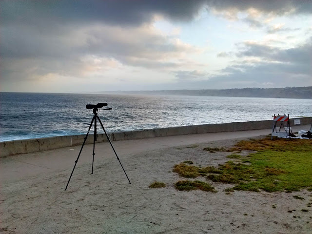
Some interesting seabirds were being seen from shore at La Jolla Cove recently. I went early one morning to scope out seabirds from the Point La Jolla vantage point. "Scope" is the correct word, because I was looking for more oceanic birds that do not approach too close to shore. A deep little canyon comes in to this natural bay. Migrating seabirds may enter into this little bay before moving out again (see map below). I was especially looking at birds 3/4 of a mile out to more than a mile-and-a-half. It requires high-powered optics and knowledge of identifying seabirds by flight style and shape more than plumage characters.

[By the way, for out-of-towners, La Jolla is pronounced as if it was Spanish: "la Hoy-ya" and not "la Jo-la." What the word means is open to debate, as jolla isn't a Spanish word. Options include the Spanish la joya meaning The Jewel, or possibly a corruption of a Native American word Woholle meaning a Hole in the Wall.]

scoping out La Jolla Cove
La Jolla Cove seawatch viewpoint from Point La Jolla at Scripps Park. Looking north across La Jolla Bay.
Point La Jolla satellite view
Point La Jolla and La Jolla Bay satellite view.
I spent an hour-and-a-half at dawn staring through my scope with my left eye. I spotted many birds, including over 100 Black Storm-Petrels and 2 Sooty Shearwaters--birds that are not easily spotted from shore. A couple new birds for the year for me were 2 Wandering Tattlers and a Black Turnstone on the rocky shores, and a Lilac-crowned Parrot screeching in the palm trees above the parking area.

Cormorants were nesting on the cliffs, terns and pelicans were diving into the water for a morning snack of fish for breakfast.

I was inches from 30 or so California Sea Lions resting and fighting on the rocks below me and noted a couple of Bottlenose Dolphins swimming by not too distant. There were also several boats, including small one-man rafts and kayaks out fishing a mile or more from shore. Several swimmers were crossing the bay--more than a mile swim across the bay in rather cold water!

Several walkers and joggers passed by, many stopping to watch the sea lions and snap some up-close photos.

After my eyes tired and I wasn't seeing anything new, I packed up the scope into the car and then followed the walkway taking some photos. I started on the east side at Goldfish Point and walked maybe 1/2 mile west to the Seal Rock. I provide a map, below.

Aerial view of La Jolla Cove
Closer view of La Jolla Cove area
The first challenge to visiting is finding a parking space. If you can't come mid-week, then arrive well before 7:00 am. Or you can drive round and round hoping someone pulls out of a parking space right in front of you. Park along Coast Boulevard. I try to park close to La Jolla Cove at Scripps Park, as that is where I scan the sea from.

Parking at La Jolla Cove
Arrive early if you want a parking space.
Starting on the east side of La Jolla Cove and facing east...

La Jolla Cave and Goldfish Point
From the same viewpoint, but now facing west down into La Jolla Cover proper. The palm tree cluster is in Scripps Park and Point La Jolla sticks out into the sea...

La Jolla Cove
La Jolla Cove
At Point La Jolla where I scope out seabirds, now looking north across the mouth of the bay...

California Sea Lions on Point La Jolla
Walking westward along the Coast Walk Trail on the seaward side of Scripps Park...

Coast Walk Trail, Scripps Park, La Jolla Cove
Scripps Park
Just west of Scripps Park is Rocky Point and a rocky beach as I look north...

Rocky Point, La Jolla Cove
Rocky Point
From the same viewpoint looking west toward the Childrens Beach (long since taken over by seals and sea lions)...

Childrens Beach and Point Mencinger
View of Childrens Beach and Point Mencinger
I finally reach Seal Rock on the west side of the Childrens Beach and can look south along the shoreline, no longer in La Jolla Bay...

Seal Rock, La Jolla
Seal Rock
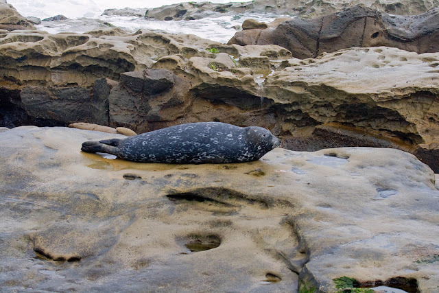
Harbor Seal on Childrens Pool Observation Walkway
For a previous birding site guide to La Jolla Cove check here.