Wednesday, September 7, 2016

Birding Site Guide: Hiking Palomar Mountain State Park

Palomar Mountain is the northernmost major birding hotspot in San Diego County. It reaches above 5000 feet and is forested in Canyon Live Oak, California Black Oak, Incense Cedar, Big-Cone Douglas-Fir, White Fir, Ponderosa Pine, and Jeffery Pine. There are grassy valleys and chaparral.

These forests have resident mountain conifer birds not regularly found in the lowlands. These include Mountain Chickadees, Steller's Jays, Red-breasted Sapsuckers, Dark-eyed Juncos, and Purple Finches. The oaks provide for resident Acorn Woodpeckers, American Robins, Nuttall's Woodpeckers, Oak Titmouses, House Wrens, Band-tailed Pigeons, and White-breasted Nuthatches. Harder to find are Brown Creepers and Red-breasted Nuthatches. Winter may irregularly bring Varied Thrushes, Cassin's Finches, Pine Siskins, Evening Grosbeaks, Townsend's Solitaires, and Red Crossbills. Summer is always enjoyable--often with cool mornings (but check the forecast). Summer residents not found in the lowlands are Olive-sided Flycatchers, Purple Martins, and Cassin's Vireos. Common spring migrants in the mountains include Hermit Warblers, Townsend's Warblers, and Wilson's Warblers.

Two regular mountain forest birds that are easier to find in the Cuyamaca Mountains and the Laguna Mountains are Hairy Woodpeckers and Pygmy Nuthatches. They show up on Palomar Mountain, but not regularly. Also hard to find, in any of the mountains of San Diego County, are White-headed Woodpeckers, Williamson's Sapsuckers, Clark's Nutcrackers, and Pinyon Jays. Any are possible, but they may not even occur every year.

Here is an eBird bar chart for birds in several combined hotspots in Palomar Mountain State Park. Use the bar chart as a way to determine variety, abundance, and seasonality, but not necessarily accurate as to exact location.

You may enjoy reading "Hiking Lower Doane Valley and French Valley" on the Modern Hiker website.


click for larger view
Getting there: It's an hour from Escondido to Palomar Mountain State Park. The most direct (fewest turns and stops) is up Interstate-15 for 15 miles to CA-76 E for another 20 miles. Then turn left on South Grade Road until you wind 7 miles to the top. Then follow the signs to the State Park. Map Navigation: 19952 State Park Road, Palomar Mountain, CA 92060. This will get you within a mile of the entrance. Parking/Fee: Enter the park at the fee booth on Hwy S7 (near A on the trail map). Fee is $8 (bring cash or check!) as of summer 2016. Pull immediately into the Silvercrest Picnic area parking lot (A on the trail map).

Palomar State Mountain birding hiking trail map
Trail map. click for larger view.
Notes and warnings

Note: If you are thinking about taking Nate Harrison Road back down to CA-76, please note that it is a steep, rutted dirt road. It may or may not be passable with many 2 wheel drive vehicles--especially after rain. All other roads are paved and in good condition.

Cell phone coverage: Depending upon weather conditions and your carrier, you may get cell coverage at Silvercrest Picnic area (A on trail map) or Boucher Fire Lookout (C on trail map).

The trails on this map are generally well-maintained dirt. Some have steep, rocky, or muddy sections. The elevation here is about 5200 feet and it is easy to get winded. Go slow and take lots of photos and no one will know you are gasping for breath! Carry water. On only one hike outlined below are you more than a half mile from your vehicle. There are flush toilets and sinks at Silvercrest picnic area parking lot. There is a pit toilet at Doane Pond. There are additional pit toilets at Boucher Hill Lookout and restrooms at Cedar Grove and Doane Valley campgrounds. There is a restaurant just outside the park boundaries and additional campgrounds on the road to Palomar Observatory, which is only 4 miles away. Gas stations are 15 miles away, back down on the road to Valley Center. Fill with gas before you come. Bring all your food and drinks with you!

Warning: Poison oak is common throughout the park, both bush and vine types--especially in drier oak/chaparral in the Weir Trail and Silvercrest Trail areas. Another plant that causes blisters and itching similar (or worse!) than poison oak is poodle-dog bush.

Where to bird: Use the map to guide your birding on three trails, detailed more below. You probably can't bird all three trails in a single day--at least, not without missing a lot of birds. There are additional trails connecting these trails. Check local trail signs when you arrive. You are not in much danger of getting lost if you stay on the well-marked and well-used trails, so go explore!

1) Silvercrest Trail (A on the trail map): 1 mile loop.

2) Upper Doane Valley/Doane Pond/Thunder Spring (T on the trail map): 1.2 mile total walk, out and back, from Doane Pond parking lot (B on the trail map).

3) Lower Doane Valley/French Valley/Weir Trail (W on the trail map): 3.5 mile loop from Doane Pond parking lot (B on the trail map).


Silvercrest Trail

Starting at the Silvercrest Picnic area parking lot (A on the trail map) a thin dirt trail heads south along the west flank of the hill. There is a lot of low brush here, unfortunately much of what isn't bracken ferns is poison oak. Check the trail condition to see if overhanging bushes have recently been cut back. If not, walk down the road to the south about a quarter mile to the park's south boundary, watching birds until you come to where the Silvercrest trail crosses the road and heads toward a park ranger's home. Yes, a sign says "no unauthorized vehicles," but that is the hiking trail. The trail then turns north along an old orchard and then goes into the forest below the entry pay booth. The trail is a bit rough and steep coming back up to the parking lot.

Silvercrest Trail looking down onto Casino and Valley Center RD
Silvercrest Trail looking down onto Casino and Valley Center Road (and coastal morning fog).
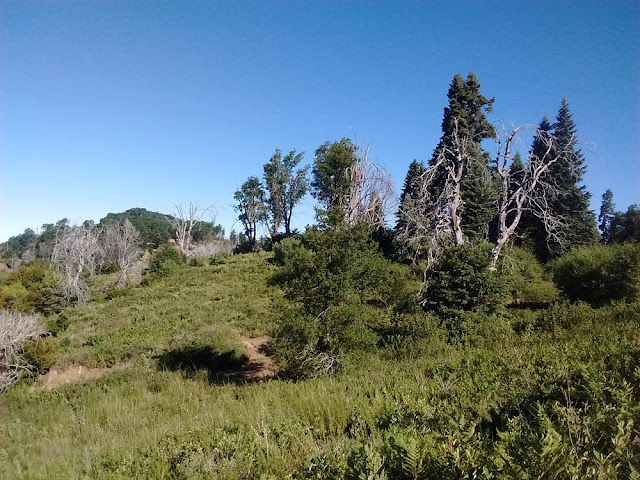
Silvercrest Trail looking at Boucher Lookout
Palomar Mountain State Park forest below fee booth
Abundant here and everywhere are the noisy Acorn Woodpeckers. Also common are Band-tailed Pigeons--after all Palomar means "dove" in Spanish. You may see rare Purple Martins coursing along the ridge, or any number of raptors. Watch for Western Tanagers and Black-headed Grosbeaks in summer, warblers in spring. The cheerful Mountain Chickadees and Western Bluebirds will keep you company here. This "first stop" will get you a quick tally of mountain forest birds, whether you hike the entire trail or just spend a few minutes birding from the parking lot.

Boucher Lookout
Boucher Lookout
There's nothing special bird-wise about the Boucher Hill fire tower (C on the trail map above). But the view is fantastic. Drive around the loop road (or hike, if you are so inclined). If the tower is open you may climb up the stairs to the fire lookout. This is worth a 20 minute to 45 minute detour, if you have time. This would be a good place to scan for hawks, eagles, and falcons. Expect Western Bluebirds and California Scrub-Jays.

Doane Pond and Upper Doane Valley trail to Thunder Spring

Drive 2 miles from Silvercrest Picnic area to Doane Pond parking lot (B on the trail map). The trail is about 0.6 miles from the parking lot, around Doane Pond, to Thunder Spring (T on the trail map). It is relatively flat. The spring is usually dry, in my experience. No thundering.
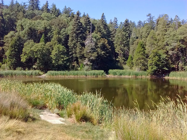
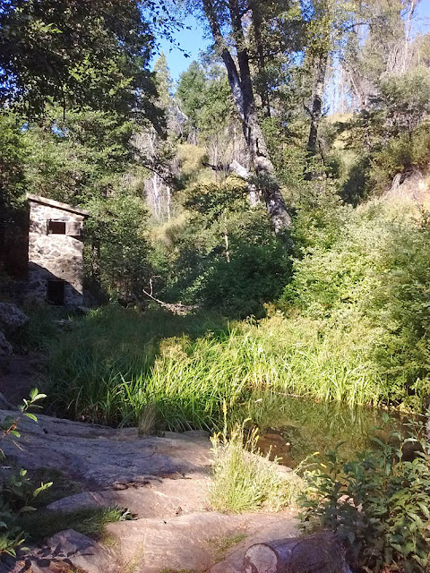
Doane Pond
Doane Pond
Upper Doane Valley looking toward Doane Pond
Upper Doane Valley looking back toward Doane Pond and the parking lot
Thunder Spring
Thunder Spring. Woo-hoo!
Doane Pond and the surrounding meadow itself can be interesting for birds. In summer watch for Purple Martins flying over the valley or skimming the pond. Lawrence's Goldfinches have been found here, in addition to the regular Lesser Goldfinches. Wood Ducks sometimes put in an appearance.

The trail to Thunder Spring stays in the conifer-oak woods and follows a creek along the west edge of the meadow. This is perhaps the most reliable spot for Red-breasted Sapsuckers. Just be patient--they don't move much and it may be 10 minutes between bouts of drumming or giving their churring call. I've found Warbling Vireos here in summer more than once. They likely breed here, in addition to being rather common migrants. The woods here may surprise with Brown Creepers or Red-breasted Nuthatches.

Here is the eBird Hotspot information for Doane Pond.

Lower Doane Valley/French Valley/Weir Trail

This is my new favorite trail in Palomar Mountain State Park. It turns out I am just the second person to add a checklist for this eBird "hotspot." Check out my September 5, 2016 list here.

Parking is at the Doane Pond lot (B on the trail map). From the southwest corner of the lot the Weir Trail enters the woods, crosses the entry road, and follows a trickling Doane Creek northward into a damp(!) old growth forest of huge big cone Douglas-fir and white fir. How unexpected! If you do nothing else, follow this trail about 1.1 miles to the end of the Weir trail (W on the trail map) and back. This is where most of the birds will be--near the water.

On the other hand, you can cut back directly from the Weir Trail to the Doane Valley Campground without adding much more to the round trip. But I recommend following the French Valley Trail loop all the way around the meadow of ponderosa pine, into black oak woodland, to the campground, for a total of about 3.5 miles and an elevation change of 450 feet (highest near the campground, lowest at the Wier). I went slow, taking photos along the way, spending just over 3 hours on this beautiful and birdy trail.

Weir Trail near Doane Pond parking lot
Weir Trail near Doane Pond parking lot. Damp old growth forest!
Weir Trail overlooking Lower Doane Valley
The Weir at the end of Weir Trail
The section of trail through the forest and along the creek has the most birds. The Acorn Woodpeckers are always loud--I tallied just short of 100 on my hike (probably an under count). But I also heard the "bouncing ball" drumming of sapsuckers on dead trees announcing their territories--even in fall. I assume that in September I was hearing the resident Red-breasted Sapsuckers, but the wintering Red-naped Sapsuckers have been see occasionally in summer, too. They didn't show themselves for me, so I don't know for sure. Several Nuttall's Woodpeckers called. Hairy Woodpecker is possible, but I didn't see or hear any. Migrant Wilson's Warblers were common here, and right in place in the willows and other thick damp creek vegetation.

As you leave the forest and get near the Weir, the creek gets more channeled and the surrounding area drier. So all the birds are there in the creek bottom puddles, bathing and drinking. The number of hummingbirds along the creek was amazing. All I saw were Anna's, but I suspect in July many might be migrating Rufous Hummingbirds. Costa's and Black-chinned are possible too. Allen's too. And maybe Calliope in spring. The chaparral above the creek had Bewick's and House Wrens. An Orange-crowned Warbler came in to look at me--either a resident bird or migrant.

I hit it good with flycatchers on my September trip. The Pacific-slope Flycatcher and Western Wood-Pewee are summer residents. But I also found a Willow Flycatcher and a Hammond's Flycatcher. Plus I had both of these fall migrants at Doane Pond. Actually, it is possible the Willow Flycatcher at the Weir was one of the rare breeding local forms.
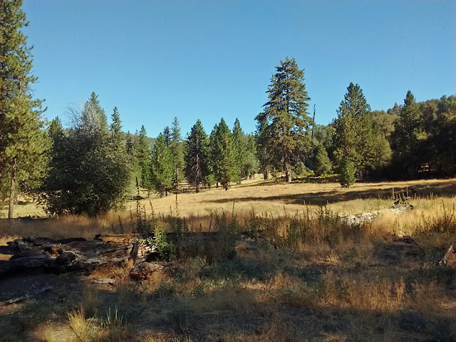
French Valley Trail
French Valley Trail
Once out in the Lower Doane Valley and French Valley, the habitat dries out to a meadow with scattered ponderosa pines. In this dry fall the only birds out were California Scrub-Jays, Acorn Woodpeckers, and a couple of Lesser Goldfinches. But soon the trail re-entered the oak woodland (California black oak and canyon live oak).

A huge black oak fallen over the trail
A huge black oak fallen over the trail.
Mountain Chickadees, Oak Titmouses, Western Bluebirds, Band-tailed Pigeons, and White-breasted Nuthatches were common here. I even had a bright male Nashville Warbler--a regular migrant in the mountains. Back near the campground Steller's Jays increased, as did Acorn Woodpeckers.... Have I mentioned there were lots of Acorn Woodpeckers?

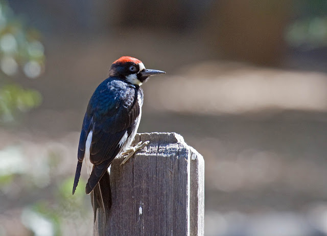
Acorn Woodpecker
Acorn Woodpecker
Mountain Chickadee
Mountain Chickadee
Palomar Observatory
Palomar Observatory
It's 4 miles from the Sate Park to the Palomar Observatory. It's worth a side trip--even if birding opportunities there are limited. There's a free gift shop/museum. You can pay for a tour of the observatory, or just walk around the grounds. One tip: the inside of the observatory is kept at the nighttime air temperature so the optics don't expand when the dome is opened at night. It can be quite cold inside!

Sunday, September 4, 2016

Birding Site Guide: Why don't I like Famosa Slough?

The eBird Hotspot for Famosa Slough lists 213 species. These include the following rare birds since 1998: Tufted Duck, Stilt Sandpiper, Tricolored Heron, Bar-tailed Godwit, Plumbeous Vireo, Ruff, Summer Tanager, Clay-colored Sparrow, Swamp Sparrow, Rose-breasted Grosbeak, and the August 2015 surprise of Gray Thrasher (probably an escaped cage bird from Tijuana but, still, a great bird to see).

The 37 acres of Famosa Slough is a tidal slough that was once part of Mission Bay's formerly extensive salt marsh wetlands. It was long ago left isolated by the channeling of the San Diego River. When birders plan to visit San Diego, high on their list is Famosa Slough. And the city is fixing it all up by planting native vegetation and adding interpretive signs. [Friends of Famosa Slough website.]

Other people like it. So why don't I? Instead of a celebrated birding location I see a weedy mud puddle behind a gas station and a couple dilapidated apartment complexes, bordered by a major thoroughfare and its deafening roar of traffic. Gang graffiti and panhandlers. I do not feel comfortable here. I feel perfectly safe birding alone anywhere in the wilderness and wilds of southern California. Why do dense urban areas disturb me so? Please pardon my prejudice against this urban birding location--I'm sure it doesn't deserve my disdain. Please tell me why you like this birding location in the comments.

Famosa Slough area map

Getting there: Famosa Slough is centrally located in the middle of several great San Diego birding hotspots. It is near Robb Field and the mouth of the San Diego River, just across from Sea World and Mission Bay. It is at the base of Point Loma and a mile from the marina for those taking pelagic birding trips. From Hwy 8 at Hwy 163 interchange follow Hwy 8 west 4.3 miles until it ends, turning left onto Sunset Cliffs Blvd, then immediately left again 0.1 miles onto Nimitz Blvd and only 0.2 miles, left onto W Point Loma Blvd for 0.5 miles and park when you reach the slough. Or, from Nimitz Blvd turn east on Famosa Blvd and follow it to the end for the south parking area. Map navigation: 4275 W Point Loma Blvd, San Diego, CA (street parking main access). 2598 Famosa Blvd, San Diego, CA (south parking lot, take surface streets around until you reach it). Parking: The north side of the slough is accessible by free street parking on Point Loma Blvd. There is free parking in a small dirt lot on the south end of the slough at the end of Famosa Blvd. During my most-recent visit in summer 2016 there is no longer a walking path from the south to north sides--you must drive around.

Famosa Slough birding map

Where to bird: The dirt parking lot at the end of Famosa Blvd (A on the map above) is the start of a loop trail in the willows on the south end of the slough. It's a small loop--maybe only 200 feet in length. Nevertheless, this is where most of the non-waterbirds are seen. Is there a rare warbler or bunting hiding in these willows? Maybe. Is there a mugger hiding in the willows? Oh no, there I went again! It's good habitat. It's worth a look. Just remember to be safe and pay attention to your surroundings.

Perhaps the city will restore a trail to the other side of the lake. But for now, drive around taking Valeta Street to Camulos Street and then turn right and park on W Point Loma Blvd (B on the map above). From here there are a couple of access points to scope out shorebirds. There is probably a best tide for choosing your visiting time, but I haven't figured it out yet.

Famosa Slough park here
This is it. Park here.
Famosa Slough main entrance
Welcome to Famosa Slough
Whimbrel
Whimbrel
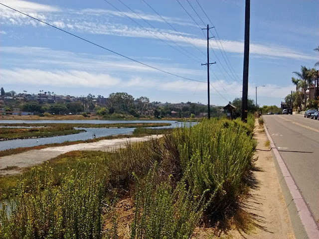
Famosa Slough

Famosa Slough northwest corner

Famosa Slough

Snowy Egret
Snowy Egret
There is a "North Channel" portion of the Famosa Slough (eBird hotspot here). There's not often much there of note, but for completeness sake I present it. Walk east down to the gas station and cross at the light on Adrian Street to the north side of very busy W Point Loma Blvd. There is a trail of 200 feet or so along the east side of the channel as it heads north under Hwy 8 and the San Diego River.

North Channel Famosa Slough
North Channel
North Channel Famosa Slough

Cassin's Kingbird
Cassin's Kingbird

Friday, September 2, 2016

A birding morning at Bonsall

Back on August 7th I spent some time exploring the Bonsall area and the new San Luis Rey River Park. I parked off Highway 76 opposite of S Mission Rd, where some construction was halted for the weekend. It was as I suspected. Even though there is an eBird Hotspot for this locale, with 68 checklists submitted, it is not publicly accessible. It may be a couple more years until trails and parking lots are installed.

I followed the only trail I could find into the riparian woods and came upon a pleasant transient camped there. Calling him a transient or homeless person, though, is pretty bigoted as he's lived in the woods there for a dozen years or more while I've lived in 8 or so different homes during that same time. So who's the transient? Anyway, he told me he was the last person living in the woods there and was soon moving out--he had a place lined up in Las Vegas, so I wish him the best.

The woods are dense without any trails, but I was able to find some birds from the edge. Of note were a couple of Common Ground Doves, Downy Woodpecker, and Bell's Vireos.

Common Ground-Dove
Common Ground-Dove. Bonsall, California. August 7, 2016. Greg Gillson.
Downy Woodpecker
Downy Woodpecker.
Someday this will be a good birding spot. But not today.