There are two species in spring that are hard to find in San Diego County that may be found here: Solitary Sandpiper which migrates through from mid April to early May, and American Bittern which may winter or breed. The wetlands and small ponds with mudflats can have other surprises in spring, which is when most birders visit.
You may also want to look at this site guide I wrote to the nearby San Elijo Lagoon.
Getting there: Travel 17 miles north on I-5 from the I-8 interchange. Take Exit 37 for Lomas Santa Fe Drive. Parking: Free street parking at the end of Santa Helena. Hours: Daylight hours. Restrooms: None. Map navigation: 982 Santa Helena, Solana Beach, California.
 |
| Stonebridge and La Orilla Trail maps (see text). Click to enlarge. |
Where to bird:
A) Parking at Santa Helena
B) Stonebridge Mesa
C) Parking at Santa Carina
D) Parking at Santa Inez
F) Parking at El Camino Real
Park at the end of Santa Helena and begin the trail (A on map). It leads north under power lines through coastal sage scrub habitat.
 |
| Start of trail (A on map) looking north toward grassy Stonebridge Mesa in middle distance. |
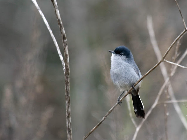
This first part of the trail has California Quail, California Thrasher, California Towhee, California Gnatcatcher, California Scrub-Jay. Also there will be other chaparral species such as Anna's and Allen's Hummingbirds, Wrentit, Bewick's Wren, and Spotted Towhees.
 |
| The trail begins under the power lines, looking north. |
Continuing north you cross marshy grass. If it has rained recently you may not be able to pass the mud. Otherwise, continue north and start up the Stonebridge Mesa and head toward B on the map. On the Mesa trail you can look down on some ponds at B on the map. You may find Black-necked Stilts, American Avocets, Greater Yellowlegs, and other shorebirds in spring and fall. A scope may be beneficial for scrutinizing shorebirds. You may carefully scan the pond edges for the occasional Solitary Sandpiper from mid-April to mid-May, and then again in September-October if water remains.
The mesa also allows you to hear birds below. Listen for Virginia and Sora rails, Marsh Wrens, and other birds. You may hear Least Bitterns. This is one of the few reliable places to hear American Bitterns in the county.
 |
| View from Stonebridge Mesa (B on map) looking south back to parking area (A) |
 |
| Looking north toward Stonebridge Mesa from La Orilla Trail between A and C on map. |
There is a dike at Santa Inez that is now closed due to construction. If I understand the signage it may remain closed in the future. When I walked it when it was open I thought maybe it would lead out into mudflats and shorebirds. But it was barren. If it ever opens again I still think it could be productive for shorebird migration, depending upon the tides and recent rains.
The main parking for the La Orilla trail is on El Camino Real (F on the map). Birders are as likely to access Stonebridge Mesa from this trailhead as from the Santa Helena access. I've never parked there and walked that section of trail, but I intend to eventually. From El Camino Real to I-5, the San Diego Freeway near Sana Inez it is about 1.5 miles.
eBird lists hotspots:
San Elijo Lagoon--east: 197 species (480 checklists--more generic location)
San Elijo Lagoon--Stonebridge Trail: 159 species (151 checklists)
San Elijo Lagoon--La Orilla Trail: 156 species (223 checklists)
Combined: 209 species
Here is a bar chart from eBird with weekly sightings.
Here are some of my bird photos from Stonebridge Trail.
 |
| California Quail. June 14, 2019. |
 |
| Juvenile White-tailed Kite. June 14, 2019. |
 |
| California Gnatcatcher. April 25, 2018. |


Thank you for such a thorough description
ReplyDelete