History of S-2 on Federal Highway Administration website.
You might say S-2 is off the beaten path, but that's not really true. For over 150 years it has been a convenient route through the desert. Even today travel on this route can be slowed by trucks and recreational vehicles avoiding the mountain route through Julian to Borrego Springs.
 |
| San Diego County map showing Agua Caliente Park. |
Take note: This is a remote desert area. Carry ample water! The nearest gas stations are at Julian, Borrego Springs, and Ocotillo, all about 20 miles distant. Many of the birding sites here have no facilities; there may be pit toilets at Blair Valley camp and Vallecito County Park. Agua Caliente Park has flush toilets and sinks. General Stores are at Stagecoach Trails RV Park, Butterfield Ranch RV Park, and outside Agua Caliente Park. Parks are closed during the hottest part of summer.
Getting there: From San Diego it is 71 miles east up Hwy 8 and then Hwy 79 through Julian and down Banner Grade on Hwy 78 to Scissors Crossing. [Coming or going from San Diego, you may wish to take the route on Hwy 8 directly to Ocotillo, then north on S-2 to Agua Caliente, 113 miles. It is 20 miles farther, but 4 minutes faster on Hwy 8 at 70 mph over the 4000 foot pass.]
Many of the sites listed here are rarely visited by birders, and then usually only in spring when migrant songbirds are passing through. If you can find water, you'll find birds here in this higher part of the desert (elevation 2000 feet, compared with Borrego Springs which is about 600 feet). Thus, I hope that publishing this guide with directions to lesser-birded sites will encourage more birders to explore and record their sightings on eBird.
Previously I wrote a mini site guide to Scissors Crossing: Summer Tanager and Brown-crested Flycatcher at Scissors Crossing.
Scissors Crossing is at milepost 17 on S-2. As you head south, the milepost numbers increase.
From Scissors Crossing, S-2 heads south 2 miles through the community of Shelter Valley, population 320 (no public facilities). South of town is the Stagecoach Trails RV Resort. There is a general store there. I've driven through the campground a couple of times. Migrant birds certainly pass through, though it doesn't get birded much (no eBird Hotspot).
Blair Valley
Soon after milepost 22 is a dirt road off to the south that leads to Little Blair Valley. There is an eBird Hotspot there, recording 57 species on 32 checklists. It looks like it gets birded an average of 3 times per year, and you are doing well if your bird list breaks double digits. I've never been down that road.
S-2 continues south and winds through a steep narrow canyon and drops into Blair Valley. The campground road is off on the left (south) just before milepost 23. It gets birded about 3 times per decade. The eBird Hotspot has 28 species on 5 checklists.
 |
| Cholla cactus at Blair Valley. S-2 mile post 24. |
Why? Why stop on this desolate stretch of road to find only a handful of birds at the best of times? Sage Thrasher, Cactus Wren, Black-throated Sparrow, Ladder-backed Woodpecker, Scott's Oriole. These last two are rather difficult to find in the county, but favor the Mojave Yucca (Yucca schidigera, Wikipedia page here). Sage Thrasher is a rare winter visitor and early spring migrant. That's what the Desert Avicaching site was set up for. Avicaching seems like a fun idea that should be expanded to other locations, habitats, dates, and species. Desert Avicaching website here.
Here, then, is a checklist made up of all the Blair Valley eBird Hotspots combined.
Vallecito County Park
Butterfield Ranch RV Park has recorded 103 species (checklist). It is on S-2 at milepost 29. The website for the RV Park does mention trails through the desert, but perhaps these are reserved for residents? I'll have to check it out some time in the future. For now, I don't know how to bird this area, but include it for completeness.
Next, continue south on S-2 past milepost 33. You will come to Vallecito County Park (website here with pdf brochure). It is a primitive campground. It is open from Labor Day to Memorial Day, closed in the heat of summer. Day use fee: $3 per vehicle. [Day use pay stub also good for Agua Caliente County Park.]
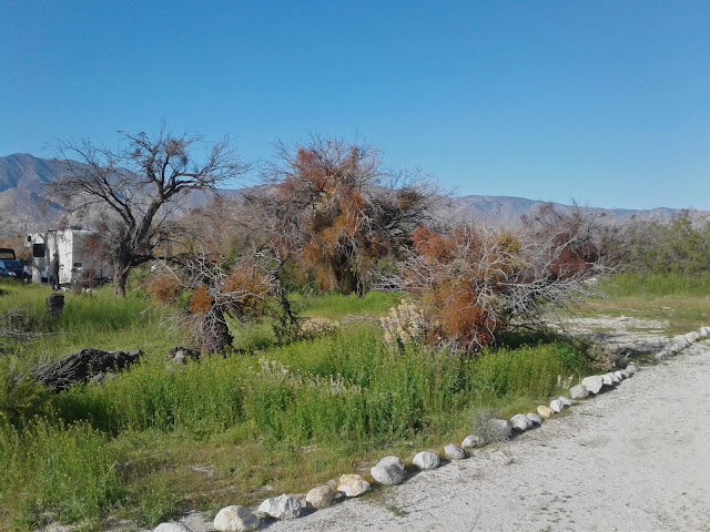 |
| Campground at Vallecito County Park. |
I can't believe that Vallecito County Park doesn't get birded more often. eBird only averages 6 checklists per year, with a total of 88 species recorded. [Checklist here.] The low birder visits is undoubtedly because most birders bypass it to get to Agua Caliente Park, next....
Agua Caliente Park
Agua Caliente is a popular park with hot spring pools, 140 campsites with full or partial hookups, and 7 cabins (website here with pdf brochure and maps).
 |
| The entrance to Agua Caliente Park. |
Where to bird: Birds may be found anywhere in the park, but most are in the following 3 areas (see map below).
1) The hot spring overflows the pool areas and runs through the campground, directly behind the Day Use area (red P on map below). So birds are concentrated near this area.
2) There is a Nature Trail (orange line on map below) within the park, starting at campsite 105, traveling through thick mesquite, and meeting up with the Entrance Road after 1/4 mile.
3) Marsh Trail leads from the entrance ranger station a mile to a spring with a few California Fan Palms. (pdf Map here) You may wish to walk the trail entirely in the wash (solid yellow line on map below), which begins on the Entrance Road where the Nature Trail ends. Dashed yellow lines are alternate routes. All trails are well marked, sandy with large rocks, but relatively level.
Most birds found elsewhere in the locations in this guide can be found here in Agua Caliente. Here is a bar chart of 132 species found in Agua Caliente Park on 277 eBird checklists.
One third of all visits are during the 2nd, 3rd, and 4th weeks of April. More than half of all eBird lists are from mid March to early May.
Resident desert birds that are common all year: California Quail, White-winged Dove, Mourning Dove, Greater Roadrunner, Anna's Hummingbird, Costa's Hummingbird, Say's Phoebe, Common Raven, Verdin, Rock Wren, Bewick's Wren, Black-tailed Gnatcatcher, California Thrasher, Northern Mockingbird, Phainopepla, House Finch, Black-throated Sparrow.
Other resident birds found less frequently: Red-tailed Hawk, Ladder-backed Woodpecker, Black Phoebe, Loggerhead Shrike, Bushtit, Cactus Wren, Blue-gray Gnatcatcher, Western Bluebird, Lesser Goldfinch.
Besides the resident desert birds, spring migration here can be strong. Flycatchers are frequent, especially Pacific-slope, Hammond's, and Western Kingbird. Summer residents include Ash-throated Flycatchers and Willow Flycatchers (after mid May). Lesser numbers of Gray Flycatchers (April) are regular.
Other spring migrants found frequently: Cassin's Vireo, Warbling Vireo, Swainson's Thrush (May), Sage Thrasher (February-March), Lawrence's Goldfinch, Chipping Sparrow, Brewer's Sparrow, Green-tailed Towhee, Yellow-breasted Chat, Hooded Oriole, Bullock's Oriole, Scott's Oriole, Brown-headed Cowbird, Great-tailed Grackle, Orange-crowned Warbler, Nashville Warbler, MacGillivray's Warbler, Common Yellowthroat, Black-throated Gray Warbler, Townsend's Warbler, Hermit Warbler, Wilson's Warbler, Western Tanager, Black-headed Grosbeak, Lazuli Bunting.
No wonder this is such a popular spring birding destination!
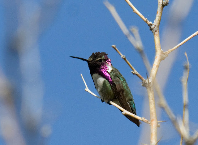 |
| Costa's Hummingbird Vallecito County Park. |
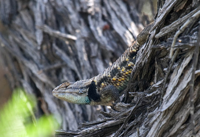 |
| Side-blotched Lizard Vallecito County Park |
 |
| Verdin Vallecito County Park |
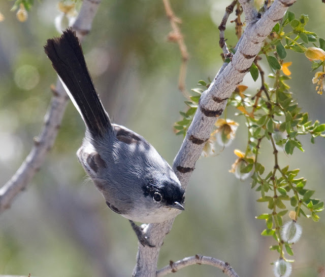 |
| Black-tailed Gnatcatcher in creosote Vallecito County Park |
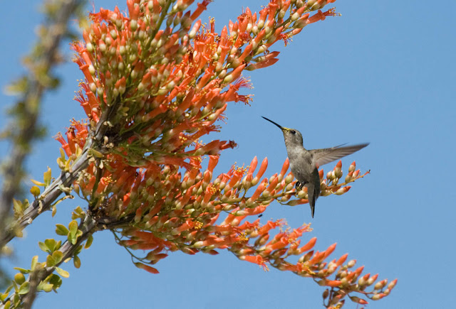 |
| Black-chinned Hummingbird in ocotillo bloom Vallecito County Park. |
 |
| Black-throated Sparrow in cholla Anza-Borrego Desert. |
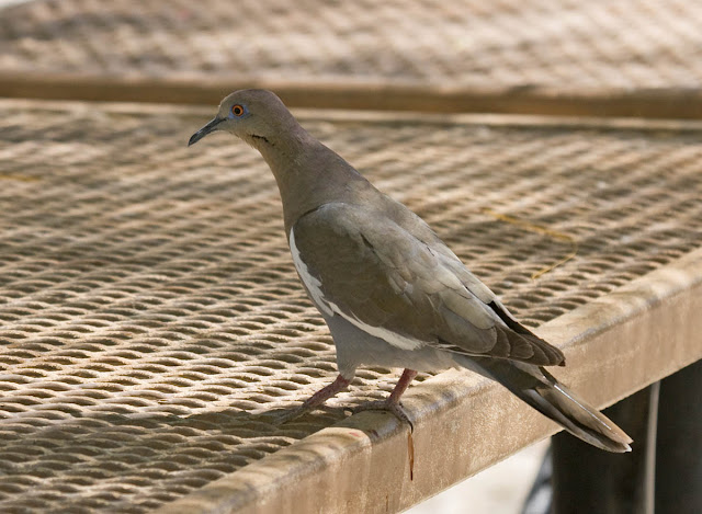 |
| White-winged Dove Agua Caliente Park. |
 |
| Bighorn Sheep Agua Caliente Park. |


No comments:
Post a Comment
I really want to hear from you! I've changed settings (again) in order to try to make commenting easier without opening it up to spammers. Please note, however, that comments to posts older than 14 days will be moderated. Thank you.