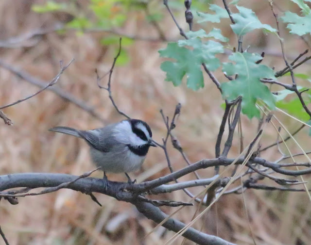
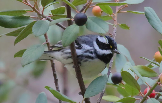
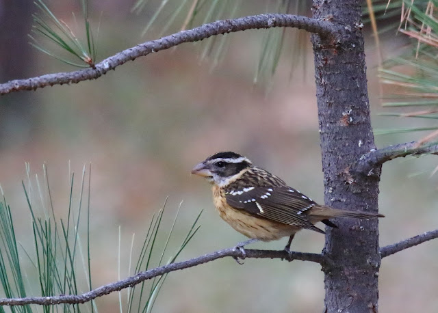
Showing posts with label site guide. Show all posts

Sunday, September 29, 2019

Site Guide: Orosco Ridge Trailhead and Pamo Valley, Ramona

North of Ramona is Pamo Valley. It is a lovely pastoral valley in the inland of San Diego's North County. The grassland is surrounded by steep chaparral-covered hills. Santa Ysabel Creek is dry for much of the year. The riparian trees include mature live oak, sycamore, cottonwoods. Cattle graze in the open range of a ranch that dates back to the 1860s. Wild Turkeys rest in the shade under the oak trees.

In previous years local birders would slowly drive the 5-mile dead end dirt road to look for unusual winter birds. These include Mountain Bluebirds and Lewis's Woodpeckers nearly every year. Golden Eagles are rare, but regular. Western Kingbirds are common in summer. But, frankly, there have been very few birders visiting here except from late December through January. But still not very many at all. Many birding hotspots in San Diego record more birding visits in one day than the total of all eBird checklists ever entered for Pamo Valley.

eBird bar chart for Pamo Valley Hotspot here.

But things have changed recently and there is a decent location now to hike around and visit oak grasslands, coastal sage scrub, and riparian sycamore and cottonwood.

A new 3-mile trail was added in January 2019 to the San Dieguito River Park Coast to Crest Trail. It now connects the Lower Santa Ysabel Truck Trail with the Upper Santa Ysabel Truck Trail along side Pamo Road. Those two trails, plus the new connector trail along Pamo Road create a 12-mile trail section. Most birders will not hike this trail.

Instead, there is a new trailhead parking area at a lush section of the Santa Ysabel Creek.

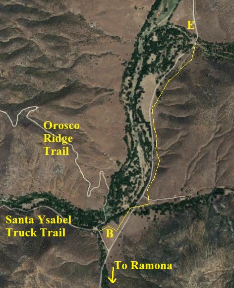
Pamo Valley map

Getting there: Travel to Ramona via Hwy 78 through Escondido and past the San Diego Zoo Wild Animal Park. Or you can go on the very curvy Highland Valley Road past birding hotspots of the Ramona Grasslands Preserve and Rangeland Road. From San Diego the less curvy route of about 40 miles is to take CA-163 north and then I-15 north to Exit 17, Mercy Road for Scripps Poway Parkway. Then take CA-67 into Ramona. Left on 7th, right on Elm, right on Haverford until it curves left (to the north) and becomes Pamo Road.
Parking: Free.
Hours: Daylight.
Restrooms: Porta-potty.
Map navigation: Orosco Ridge Trailhead, Forest Rte 12S04, Ramona, CA 92065

Pamo Valley map

Where to bird: Driving Pamo Road

Birding here generally starts on Pamo Road just as you pass the landfill (A on the map above). From here Pamo Road descends a rather steep grade of more than a mile. There always seems to be interesting raptors and other birds, but no real place to pull over and stop.

At the bottom of the grade you come to the new Orosco Ridge Trailhead parking area (B on map). From here it is just over 4 miles to the end of the public road at a ranch house (C on the map). Driving this section of road and pulling over to view birds used to be the only birding here. And it still is enjoyable. But we'll go back to B and spend time there after I first tell you about other areas on the map above.

I have driven Pamo Road in April at night and recorded Western Screech-Owl, Great Horned Owl, and Common Poorwill.

Nearby at Black Canyon Road:

As you leave Ramona via CA-78 on the north end of town you can turn north on Magnolia Street, which becomes Black Canyon Road. This is another little valley, but dry chaparral. In spring it has Bell's Sparrows and similar birds. There is a riparian area to park at the old Black Canyon Bridge (D on the map). I wrote a site guide several years ago to Black Canyon Road. You can drive from Black Canyon Road to Lake Sutherland and back to Ramona and CA-78 via Sutherland Dam Road.

I have driven north 14 miles from Black Canyon bridge (D) to Lake Henshaw via Mesa Grande.

You can hike from Pamo Valley to Black Canyon Road (B to D) but you cannot drive easily between the two valleys.

Where to bird: Orosco Ridge Trailhead

Okay, back to the Orosco Ridge Trailhead (B on the map above and below).

Pamo Valley map

The new trail parallels Pamo Road. The first 1.25 miles of trail (highlighted with thin yellow line above) crosses riparian zones twice. It would be good for roadside and grassland birds. At each of the little creek crossings there will be Oak Titmouses, Spotted Towhees, Acorn Woodpeckers, American Kestrels, Western Bluebirds.

But walking down into the riparian from the trailhead is likely to be most productive. In my short visit at noon in September 2019 I found House Wrens, Nuttall's Woodpeckers, Lesser Goldfinches, Spotted Towhee, a Red-shouldered Hawk, Western Wood-Pewee. I heard Wrentits. I walked a short distance up the Orosco Ridge trail--to the second hairpin turn--where a pair of Rock Wrens were flitting about in the hillside.

The creek bottom was dry and the lush grass amid the trees was cut short by cows that graze there. A group of Wild Turkeys eyed me warily. I think this area could be quite productive in spring. I would just walk at the edges of the stream bottom, as I assume the ground would be damp in spring.

I think that it may also be interesting to walk a ways down the riparian along the Santa Ysabel Truck Trail. I imagine that chaparral sparrows would be good in April, and neotropical migrants would be good in May.

Pamo Valley is a pleasant place to watch roadside birds. Now there's even more opportunities to visit with some walking into the oak and riparian creek bottom that hasn't been available until recently.

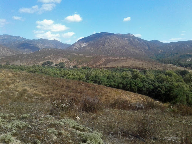
Photo of Orosco Ridge Trailhead, Pamo Valley

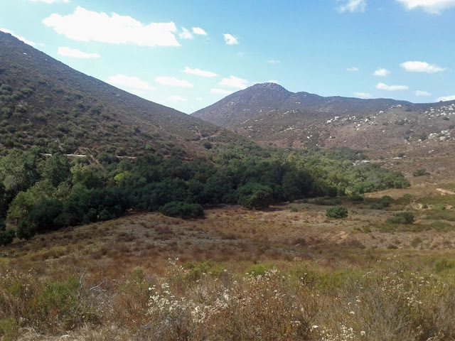
Photo of Orosco Ridge Trailhead, Pamo Valley

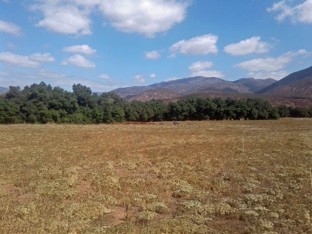
Photo of Orosco Ridge Trailhead, Pamo Valley

Photo of Orosco Ridge Trailhead, Pamo Valley

Friday, September 27, 2019

Site Guide: Stonebridge Trail, Solana Beach

Upstream 2 miles from the ocean at the mouth of the San Elijo Lagoon in Solano Beach is the Stonebridge Trail. It is one of several short trails in the area that can be good for birds in the river bottom. In winter and spring there may be water to block full access to some of the trails, but it is fairly dry during most of the year.

There are two species in spring that are hard to find in San Diego County that may be found here: Solitary Sandpiper which migrates through from mid April to early May, and American Bittern which may winter or breed. The wetlands and small ponds with mudflats can have other surprises in spring, which is when most birders visit.

You may also want to look at this site guide I wrote to the nearby San Elijo Lagoon.

Getting there: Travel 17 miles north on I-5 from the I-8 interchange. Take Exit 37 for Lomas Santa Fe Drive. Parking: Free street parking at the end of Santa Helena. Hours: Daylight hours. Restrooms: None. Map navigation: 982 Santa Helena, Solana Beach, California.

Map showing location of Solana Beach and San Diego area

Stonebridge and La Orilla Trail maps (see text). Click to enlarge.

Where to bird:

A) Parking at Santa Helena
B) Stonebridge Mesa
C) Parking at Santa Carina
D) Parking at Santa Inez
F) Parking at El Camino Real

Park at the end of Santa Helena and begin the trail (A on map). It leads north under power lines through coastal sage scrub habitat.

Photo of view from Stonebridge Trail
Start of trail (A on map) looking north toward grassy Stonebridge Mesa in middle distance.

This first part of the trail has California Quail, California Thrasher, California Towhee, California Gnatcatcher, California Scrub-Jay. Also there will be other chaparral species such as Anna's and Allen's Hummingbirds, Wrentit, Bewick's Wren, and Spotted Towhees.

Photo of view from Stonebridge Trail
The trail begins under the power lines, looking north.
After about 1000 feet you meet up with the La Orilla Trail intersection. Here you will encounter the riparian willows and shrubby trees. In spring you will find Yellow-breasted Chats, Black-headed Grosbeaks, Common Yellowthroats, Orange-crowned Warblers, Brown-headed Cowbirds, and Red-winged Blackbirds.

Continuing north you cross marshy grass. If it has rained recently you may not be able to pass the mud. Otherwise, continue north and start up the Stonebridge Mesa and head toward B on the map. On the Mesa trail you can look down on some ponds at B on the map. You may find Black-necked Stilts, American Avocets, Greater Yellowlegs, and other shorebirds in spring and fall. A scope may be beneficial for scrutinizing shorebirds. You may carefully scan the pond edges for the occasional Solitary Sandpiper from mid-April to mid-May, and then again in September-October if water remains.

The mesa also allows you to hear birds below. Listen for Virginia and Sora rails, Marsh Wrens, and other birds. You may hear Least Bitterns. This is one of the few reliable places to hear American Bitterns in the county.

Photo of view from Stonebridge Trail
View from Stonebridge Mesa (B on map) looking south back to parking area (A)
You've now walked about 3000 feet, almost 3/4 of a mile. It's about 1.25 miles round trip from the parking area out and around the Stonebridge Mesa and back to the car. If I have additional time I sometimes go back to the Orilla Trail and head westward on the trail, skirting more wet marshes, toward C on the map. Then I head back.

Photo of view from Stonebridge Trail
Looking north toward Stonebridge Mesa from La Orilla Trail between A and C on map.
I've also done some birding from the trailheads from Santa Carina and Santa Inez. I haven't found it to be as productive. The freeway noise can be overwhelming--at least, for trying to hear birds.

There is a dike at Santa Inez that is now closed due to construction. If I understand the signage it may remain closed in the future. When I walked it when it was open I thought maybe it would lead out into mudflats and shorebirds. But it was barren. If it ever opens again I still think it could be productive for shorebird migration, depending upon the tides and recent rains.

The main parking for the La Orilla trail is on El Camino Real (F on the map). Birders are as likely to access Stonebridge Mesa from this trailhead as from the Santa Helena access. I've never parked there and walked that section of trail, but I intend to eventually. From El Camino Real to I-5, the San Diego Freeway near Sana Inez it is about 1.5 miles.
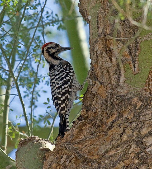
eBird lists hotspots:
San Elijo Lagoon--east: 197 species  (480 checklists--more generic location)
San Elijo Lagoon--Stonebridge Trail: 159 species  (151 checklists)
San Elijo Lagoon--La Orilla Trail: 156 species  (223 checklists)

Combined: 209 species
Here is a bar chart from eBird with weekly sightings.

Here are some of my bird photos from Stonebridge Trail.

Photo of California Quail at Stonebridge Trail
California Quail. June 14, 2019.
Photo of White-tailed Kite at Stonebridge Trail
Juvenile White-tailed Kite. June 14, 2019.
Photo of California Gnatcatcher at Stonebridge Trail
California Gnatcatcher. April 25, 2018.

Monday, June 10, 2019

Site Guide: Blair Valley, Agua Caliente, and Vallecito County Parks

If you find beauty in desolate landscapes, and love desert birding, California Highway S-2 is for you. Known by several names, including San Felipe Road and the Great Overland Stage Route of 1849--now there's a road name for you--this road starts in the north at Warner Springs and winds south to Ocotillo.

History of S-2 on Federal Highway Administration website.

You might say S-2 is off the beaten path, but that's not really true. For over 150 years it has been a convenient route through the desert. Even today travel on this route can be slowed by trucks and recreational vehicles avoiding the mountain route through Julian to Borrego Springs.

San Diego County map showing Agua Caliente Park
San Diego County map showing Agua Caliente Park.
There are several areas to watch birds on this route, but this guide starts at Scissors Crossing (the Hwy 78 and S-2 intersection), 12 miles south of Julian (and almost 2000 feet lower), and continues south to Agua Caliente County Park.

Take note: This is a remote desert area. Carry ample water! The nearest gas stations are at Julian, Borrego Springs, and Ocotillo, all about 20 miles distant. Many of the birding sites here have no facilities; there may be pit toilets at Blair Valley camp and Vallecito County Park. Agua Caliente Park has flush toilets and sinks. General Stores are at Stagecoach Trails RV Park, Butterfield Ranch RV Park, and outside Agua Caliente Park. Parks are closed during the hottest part of summer.

Getting there: From San Diego it is 71 miles east up Hwy 8 and then Hwy 79 through Julian and down Banner Grade on Hwy 78 to Scissors Crossing. [Coming or going from San Diego, you may wish to take the route on Hwy 8 directly to Ocotillo, then north on S-2 to Agua Caliente, 113 miles. It is 20 miles farther, but 4 minutes faster on Hwy 8 at 70 mph over the 4000 foot pass.]

Many of the sites listed here are rarely visited by birders, and then usually only in spring when migrant songbirds are passing through. If you can find water, you'll find birds here in this higher part of the desert (elevation 2000 feet, compared with Borrego Springs which is about 600 feet). Thus, I hope that publishing this guide with directions to lesser-birded sites will encourage more birders to explore and record their sightings on eBird.

Vicinity map of Agua Caliente and Vallecito Parks

Previously I wrote a mini site guide to Scissors Crossing: Summer Tanager and Brown-crested Flycatcher at Scissors Crossing.

Scissors Crossing is at milepost 17 on S-2. As you head south, the milepost numbers increase.

From Scissors Crossing, S-2 heads south 2 miles through the community of Shelter Valley, population 320 (no public facilities). South of town is the Stagecoach Trails RV Resort. There is a general store there. I've driven through the campground a couple of times. Migrant birds certainly pass through, though it doesn't get birded much (no eBird Hotspot).

Blair Valley

Soon after milepost 22 is a dirt road off to the south that leads to Little Blair Valley. There is an eBird Hotspot there, recording 57 species on 32 checklists. It looks like it gets birded an average of 3 times per year, and you are doing well if your bird list breaks double digits. I've never been down that road.

S-2 continues south and winds through a steep narrow canyon and drops into Blair Valley. The campground road is off on the left (south) just before milepost 23. It gets birded about 3 times per decade. The eBird Hotspot has 28 species on 5 checklists.

Cholla cactus in Blair Valley
Cholla cactus at Blair Valley. S-2 mile post 24.
At mile post 24 is a pull out and sandy track on the south side of the road. Keeping left on this road less than 1/4 mile leads to a one-car pull out that serves as parking for the eBird Hotspot named "Blair Valley No. 2 (Desert Avicaching)."

Why? Why stop on this desolate stretch of road to find only a handful of birds at the best of times? Sage Thrasher, Cactus Wren, Black-throated Sparrow, Ladder-backed Woodpecker, Scott's Oriole. These last two are rather difficult to find in the county, but favor the Mojave Yucca (Yucca schidigera, Wikipedia page here). Sage Thrasher is a rare winter visitor and early spring migrant. That's what the Desert Avicaching site was set up for. Avicaching seems like a fun idea that should be expanded to other locations, habitats, dates, and species. Desert Avicaching website here.

Here, then, is a checklist made up of all the Blair Valley eBird Hotspots combined.

Vallecito County Park

Butterfield Ranch RV Park has recorded 103 species (checklist). It is on S-2 at milepost 29. The website for the RV Park does mention trails through the desert, but perhaps these are reserved for residents? I'll have to check it out some time in the future. For now, I don't know how to bird this area, but include it for completeness.

Next, continue south on S-2 past milepost 33. You will come to Vallecito County Park (website here with pdf brochure). It is a primitive campground. It is open from Labor Day to Memorial Day, closed in the heat of summer. Day use fee: $3 per vehicle. [Day use pay stub also good for Agua Caliente County Park.]

Vallecito County Park
Campground at Vallecito County Park.
Where to bird: Although the park has 71 acres, birding is done by parking in the Day Use lot and walking the campground around the 44 camp sites. The fence on the south of the campground borders a damp meadow. Listen carefully for singing Yellow-breasted Chats and Bell's Vireos that nest. Otherwise, the typical desert birds such as Verdin, White-winged Dove, Costa's Hummingbird, Black-tailed Gnatcatcher, and Phainopepla are resident, and migrants are attracted to the trees in the campground.

I can't believe that Vallecito County Park doesn't get birded more often. eBird only averages 6 checklists per year, with a total of 88 species recorded. [Checklist here.] The low birder visits is undoubtedly because most birders bypass it to get to Agua Caliente Park, next....

Agua Caliente Park

Agua Caliente is a popular park with hot spring pools, 140 campsites with full or partial hookups, and 7 cabins (website here with pdf brochure and maps).

Agua Caliente Park
The entrance to Agua Caliente Park.
Open from Labor Day to Memorial Day, only; closed during the heat of summer, the Day Use area is right at the entrance of Agua Caliente Park. If you've already paid the $3 Day Use fee at Vallecito County Park, you don't need to buy another.

Where to bird: Birds may be found anywhere in the park, but most are in the following 3 areas (see map below).

1) The hot spring overflows the pool areas and runs through the campground, directly behind the Day Use area (red P on map below). So birds are concentrated near this area.

2) There is a Nature Trail (orange line on map below) within the park, starting at campsite 105, traveling through thick mesquite, and meeting up with the Entrance Road after 1/4 mile.

3) Marsh Trail leads from the entrance ranger station a mile to a spring with a few California Fan Palms. (pdf Map here) You may wish to walk the trail entirely in the wash (solid yellow line on map below), which begins on the Entrance Road where the Nature Trail ends. Dashed yellow lines are alternate routes. All trails are well marked, sandy with large rocks, but relatively level.

Agua Caliente birding trail map

Most birds found elsewhere in the locations in this guide can be found here in Agua Caliente. Here is a bar chart of 132 species found in Agua Caliente Park on 277 eBird checklists.

One third of all visits are during the 2nd, 3rd, and 4th weeks of April. More than half of all eBird lists are from mid March to early May.

Resident desert birds that are common all year: California Quail, White-winged Dove, Mourning Dove, Greater Roadrunner, Anna's Hummingbird, Costa's Hummingbird, Say's Phoebe, Common Raven, Verdin, Rock Wren, Bewick's Wren, Black-tailed Gnatcatcher, California Thrasher, Northern Mockingbird, Phainopepla, House Finch, Black-throated Sparrow.

Other resident birds found less frequently: Red-tailed Hawk, Ladder-backed Woodpecker, Black Phoebe, Loggerhead Shrike, Bushtit, Cactus Wren, Blue-gray Gnatcatcher, Western Bluebird, Lesser Goldfinch.

Besides the resident desert birds, spring migration here can be strong. Flycatchers are frequent, especially Pacific-slope, Hammond's, and Western Kingbird. Summer residents include Ash-throated Flycatchers and Willow Flycatchers (after mid May). Lesser numbers of Gray Flycatchers (April) are regular.

Other spring migrants found frequently: Cassin's Vireo, Warbling Vireo, Swainson's Thrush (May), Sage Thrasher (February-March), Lawrence's Goldfinch, Chipping Sparrow, Brewer's Sparrow, Green-tailed Towhee, Yellow-breasted Chat, Hooded Oriole, Bullock's Oriole, Scott's Oriole, Brown-headed Cowbird, Great-tailed Grackle, Orange-crowned Warbler, Nashville Warbler, MacGillivray's Warbler, Common Yellowthroat, Black-throated Gray Warbler, Townsend's Warbler, Hermit Warbler, Wilson's Warbler, Western Tanager, Black-headed Grosbeak, Lazuli Bunting.

No wonder this is such a popular spring birding destination!

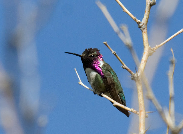
Costa's Hummingbird Vallecito County Park.
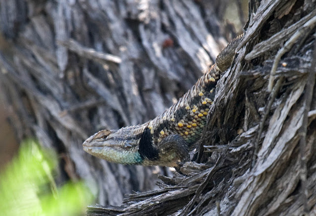
Side-blotched Lizard Vallecito County Park
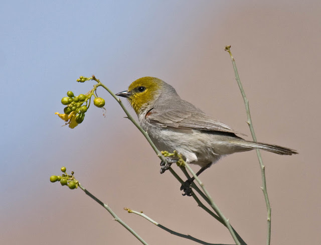
Verdin Vallecito County Park
Black-tailed Gnatcatcher in creosote Vallecito County Park
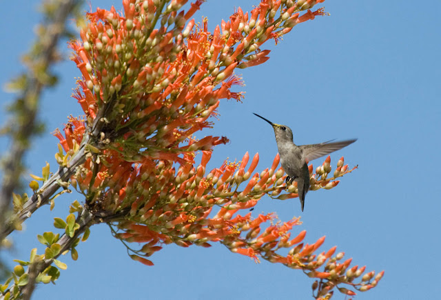
Black-chinned Hummingbird in ocotillo bloom Vallecito County Park.
Black-throated Sparrow in cholla Anza-Borrego Desert.
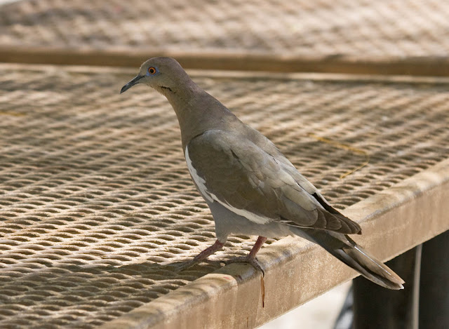
White-winged Dove Agua Caliente Park.
Bighorn Sheep Agua Caliente Park.

Thursday, May 9, 2019

Site Guide: ABDNHA Botanical Garden, Borrego Springs

It's a tiny little park, much less than an acre in size. It's hidden away in "downtown" Borrego Springs.

Nevertheless, the Anza-Borrego Desert Natural History Association Botanical Garden consistently has some good desert birds that give some close views: Common Ground-Dove, Cactus Wren, Costa's Hummingbird, White-winged Dove, and Verdin are regular. And the desert plants are identified for you. And, every time I go back there are a few more plants and trees added.

Stop in for 5 minutes, or eat a picnic lunch and spend a bit more time here. The address is 652 Palm Canyon Drive, Borrego Springs, California. The little garden is behind parking lot between the ABDNHA Nature Center and Carlee's Restaurant.

After my first visit I requested it be added as an eBird Hotspot. There is ample opportunity for you to add sightings of species not yet seen, as well as many times of year without any visits. The eBird hotspot checklist is here.

Borrego Springs satellite map (Google).
The three photos below are pretty much 3 different views of the same entire area in March 2019. The official website is here.

ABDNHA Botanical Garden

ABDNHA Botanical Garden

ABDNHA Botanical Garden

Some of my photos of birds at the Botanical Garden...

Verdin
Verdin
Ladder-backed Woodpecker
Costa's Hummingbird
Costa's Hummingbird
Common Ground-Dove
Common Ground-Dove

Monday, February 4, 2019

Site Guide: Lake Wohlford, Escondido

Lake Wohlford
South side of Lake Wohlford looking toward east end. December 2019.
Lake Wohlford is a fishing lake and residential drinking water reservoir (no swimming or wading or pets). It's in a rural setting in the hills northeast of Escondido.

The open grassy north shore has picnicking, and boat rentals at the ranger station. You may walk the fishing trails along the lake, searching the cattails, open water, or grassy knolls between the lake and main road.

The south side of the lake is more conducive to birding as the Egret Trail goes through an Engelmann's oak woodland where a Bald Eagle winters (or is perhaps a resident).

As far as unusual species go, this lake has a fair number of winter reports of Common Mergansers compared to the County as a whole.

Note: Saturday and Sundays only from early September until mid-December, otherwise 7 days a week, sunrise to sunset. You might check first before driving out.

Escondido City webpage for Lake Wohlford: www.escondido.org/lake-wohlford.aspx


Getting there: Escondido is reached via I-15 north 20 miles from I-8 in San Diego. Take exit 27 "E Via Rancho Pkwy." Turn right on Bear Valley Pkwy for 6 miles, then turn right on Valley Parkway. After 1.3 miles turn right on Lake Wohlford Rd. After 1.9 miles on Lake Wohlford Road you have two choices, designated "North side of lake" and "South side of lake" below.


North side of lake
From the "Getting there" directions above, continue 0.7 miles to the Ranger Station. Parking: Free. Hours: Dawn to dusk. Map Navigation: 25453 Lake Wohlford Rd. Escondido, California 92025.

Where to bird: From ranger station the unsigned Osprey Trail goes west 0.25 miles to red buoy line. In the other direction, from ranger station head east 0.5 miles on unsigned Kumeyaay Trail above the fishing trails at the lake shore to the east buoy line where the trail ends.

South side of lake
From the "Getting there" directions above, turn right on Oakvale Rd. Travel 0.7 to easily-missed dirt parking are on left, Lake Wohlford Park. Parking: Free. Hours: Dawn to dusk. Map Navigation: approximately 14972 Oakvale Rd, Escondido, California 92025.

Where to bird: Egret Trail starts at Lake Wohlford Park and follows the lake shore east about 1/2 mile where it joins up with Oakvale Road. You may walk gated Oakvale Road an additional 1/2 mile east. Then you return to Lake Wohlford Park on Oakvale Road, walking past the residential homes. I detected just over 50 avian species in early December 2018, and meandered 3 miles, including a lot of side fishing trails.

Some cautions about Egret trail: poison oak is the major shrub, rattlesnakes are possible, and it is a bit isolated because of the dense but narrow woodland, though in earshot of some homes. Dirt trail can be muddy or rutted and uneven, generally a moderate hike, with very little elevation gain. I've seen only fishermen and hikers, including families, on these trails--nothing suspicious.

Portable toilets in several areas on both north and south shores.

Usually this is a rather quiet retreat, except for occasional boat motors. However, one day the lake served as the focus of a plane doing aerobatics--not good for birding.

Looking over eBird data there were 11 different groups of birders reporting in January 2019. That's compared to 37 different birding groups in all of 2018. Very few or no birders visit July-October, though certainly there will be birds here, and not too hot if you arrive early. 162 species have been recorded here. The eBird bar chart is here.

Lake Wohlford
South side of Lake Wohlford looking north.
Lake Wohlford
South side of Lake Wohlford looking westward. The ranger station is visible on the north side of the lake.

Sunday, October 28, 2018

Birding Site Guide: Agua Dulce Creek, Laguna Mountains

The Laguna Mountains are the southernmost pine forests in San Diego County in the Descanso Ranger District of Cleveland National Forest. This location is easily accessed from San Diego on I-8, the interstate rising to over 5000 feet of elevation, less than 50 miles east from downtown.

To the north in San Diego County are the Cuyamaca Mountains, the thousands of acres of conifers of which were nearly completely incinerated in the 2003 Cedar Fire, except for a few remaining on Cuyamaca Peak (site guide here) and at Stonewall Mine and Lake Cuyamaca (site guide here). Farther north yet is Palomar Mountain (site guide here).

The "town" here is Mount Laguna, population 57 in the 2010 census. The general store opens at 9:00 am.

There are many places to watch birds in this forest. The most well-known starting place is the roadside parking along Sunrise Highway (S1) at the meadow at mile post 19 (A on Map 2). This is the starting point for snow play following rather rare winter storms. And there is forest hiking year-round.

In this site guide I describe Agua Dulce Creek. I visited in October 2018 intending on exploring for writing up this site guide, but not having specific information. Fortunately, I met Tuck Russell and after birding together to find rare Clark's Nutcrackers and Pinyon Jays, he showed me around Agua Dulce Creek.

There is rarely water flowing in the creek, except immediately after recent snows or rains. But there are a few "permanent" puddles, and willows and other streamside vegetation follow the ravine. There are fewer recreational hikers and riders (horse and bicycles) here than on other nearby trails.

The Laguna Mountain Volunteer Association has an excellent trail map/brochure, available at the Visitor's Information Center. Unfortunately, I couldn't find a pdf online. One downloadable tif version appears in the Hiking Lady blog.

Getting there: From the I-15/I-8 interchange in San Diego, take I-8 38 miles east to Exit 47 to the Sunrise Hwy (S1). Continue about 8.5 miles to Wooded Hill Road (about mile post 21.7; B on Map 2 below). Drive in about one-half of mile. Pass by the Wooded Hill Group Camp and park in the Agua Dulce Equestrian Trailhead lot. Parking: Adventure Pass required. Hours: Dawn to dusk. Maps Navigation: Agua Dulce Trailhead, Wooded Hill Road, Mount Laguna, CA 91948.

Note: You must have an Adventure Pass to park in most areas here. A day pass on my visit in October 2018 was available for $5 at Mount Laguna store (Friday-Sunday, but doesn't open until 9:00 am). Adventure Passes are sold at outdoor stores, specifically, in the San Diego area: Big 5 Sporting Goods (Adventure Pass Vendor list).

Map 1
Map 2. A is mile post 19 and immediate trails. B is Wooded Hill Rd.
Where to bird: Hike the narrow, but well-defined, dirt trail (rut) east from the Equestrian Trailhead parking lot (P on Map 3). This leads down to a meadow. The trail turns north (photo below). Follow the trail down the narrow valley until the creek forms. The hiking is moderately difficult (not strenuous) with a definite elevation change.

At a small pumphouse (X on Map 3), take the trail across the creek. Turn back south for a hundred feet or so on the other side of the now-formed creek. This is where you are most likely to find some pools of water with birds coming in to drink. Then turn around and follow the trail along the east side of the creek, down to the north. Soon the trail joins a dirt road alongside the creek. After a half mile the road splits (Y on Map 3). The left hand fork follows the creek, but you may choose to turn around any time. Tuck and I went another 1/4 mile or so on our visit, just before the trail reaches the edge of Laguna Meadow.

To return, follow your steps, now up to the south!

Map 3.
A little meadow just east of the parking area looking north. Follow the trail down the valley to the creek.
The trail crosses Agua Dulce Creek at the little pumphouse; X on Map 3.
Agua Dulce Creek. Typical Jeffery Pine and "creek side" habitat.
Agua Dulce Creek. Lower trail opening up into Black Oaks.
What kind of birds should you expect here?

Resident birds include Mountain Quail (most often detected in spring when calling), Band-tailed Pigeon, Red-tailed Hawk, Acorn Woodpecker, Nuttall's Woodpecker, Northern Flicker, Steller's Jay, California Scrub-Jay, Common Raven, Mountain Chickadee, Oak Titmouse, White-breasted Nuthatch, Pygmy Nuthatch, Brown Creeper (secretive), House Wren, Western Bluebird, Purple Finch, Dark-eyed (Oregon) Junco, Spotted Towhee.

Summer birds include Mourning Dove, Anna's Hummingbird, Turkey Vulture, Olive-sided Flycatcher, Western Wood-Pewee, Pacific-slope Flycatcher, Ash-throated Flycatcher, Cassin's Vireo, Violet-green Swallow, Bushtit, American Robin, House Finch, Lesser Goldfinch, Lawrence's Goldfinch, Chipping Sparrow, Lark Sparrow, California Towhee, Orange-crowned Warbler, Western Tanager, Black-headed Grosbeak.

Winter visitors include Williamson's Sapsucker (rare), Red-naped Sapsucker (rare), Golden-crowned Kinglet (rare), Ruby-crowned Kinglet, Hermit Thrush, Cassin's Finch (rare), Dark-eyed (Gray-headed) Junco (rare), White-crowned Sparrow, Golden-crowned Sparrow (rare).

Spring (late April and May) and especially fall migration (late August through October) are the key times to visit. You will see resident birds and perhaps some of the longer-staying summering or wintering birds. Regular migrants include: Rufous Hummingbird, Sharp-shinned Hawk (fall), Cooper's Hawk (fall), Red-shouldered Hawk (fall), Western Kingbird (spring), Hammond's Flycatcher, Warbling Vireo, Swainson's Thrush, Lincoln's Sparrow, Fox Sparrow (fall, Slaty-backed and Sooty), Nashville Warbler (fall), MacGillivray's Warbler, Yellow Warbler, Black-throated Gray Warbler, Townsend's Warbler, Hermit Warbler, Wilson's Warbler, Lazuli Bunting (rare).

Rare birds (mostly birds near the edge of their normal range) will be attracted to the water during migration--especially in fall, when other sources of water are hard to find. Conifer cones ripen in fall and early winter and may attract other rarities. Some rare birds may winter. Some rare birds have been found in summer. Rarities here have included: Northern Saw-whet Owl (resident calling in spring and summer), Dusky Flycatcher (spring), Willow Flycatcher (spring/fall), Plumbeous Vireo (fall), Clark's Nutcracker (fall), Red-breasted Nuthatch (year-round), Pacific Wren (spring), Blue-gray Gnatcatcher (summer), Townsend's Solitaire (fall), Varied Thrush (fall), Red Crossbill (fall), Pine Siskin (spring), Green-tailed Towhee (fall), Painted Redstart (summer), Hepatic Tanager (summer), Indigo Bunting (summer).

Here is an eBird weekly frequency bar chart of birds at this location.

And a selection of bird photos from my recent trip on October 7, 2018:

Mountain Chickadee
Mountain Chickadee
Acorn Woodpecker
Acorn Woodpecker
Steller's Jay
Steller's Jay
Hairy Woodpecker
Hairy Woodpecker
Wilson's Warbler
Wilson's Warbler
Hermit Thrush
Hermit Thrush
Green-tailed Towhee
Green-tailed Towhee
Brown Creeper
Brown Creeper
Ruby-crowned Kinglet
Black-throated Gray Warbler
Black-headed Grosbeak