Showing posts with label bird finding. Show all posts

Friday, June 30, 2017

Coastal Sage Scrub and California Gnatcatcher

I'm so used to seeing coastal sage scrub as dry, colorless, grays and tans. It is really amazing to see how green everything is this spring after near-record winter rainfall. I spent about a half hour recently walking a trail east of I-5 along the coast at the San Elijo Lagoon. I noticed the habitat restoration sign showing California Gnatcatcher and grabbed the picture below with my phone on May 17.

Coastal Sage Scrub
Coastal Sage Scrub, San Elijo Lagoon, May 17, 2017.
While the gnatcatchers may often be heard and glimpsed here, the photos below came from inland at Lake Hodges on April 26.

California Gnatcatcher
California Gnatcatcher, Lake Hodges, April 26, 2017.
California Gnatcatcher

California Gnatcatcher
Prickly Pear
Prickly Pear Cactus, San Elijo Lagoon, May 17, 2017.

Friday, November 4, 2016

Le Conte's Thrasher at Borrego Springs

Four-and-a-half miles east of Christmas Circle roundabout in Borrego Springs, on Palm Canyon Road, is a sharp left curve that marks the beginning of Peg Leg Road. It is here that you turn right on to Dump Road. At a sharp right turn are signs for the Old Springs Road Open Space Preserve off to the east. Park along the road here and walk east. (Am I the only one that gets my internal compass mixed up here? I have to fight to keep from feeling east is south and west is north in Borrego Valley.)

The desert here is right on the edge of sand dunes with Fonts Point to the east. Walk that direction. The widely--and evenly--spaced creosote bushes along the road give way after a few hundred feet to what I believe are scattered big saltbush (see photo below). You are now in prime Le Conte's Thrasher habitat. As Sibley describes it: "Uncommon, local, and secretive on extremely arid and sparsely vegetated plains with saltbush and creosote bush and lots of bare sandy ground. Solitary; most often seen running across the ground from one bush to another."--Sibley Guide to Birds: second edition (2014).

Old Springs Road Open Space Preserve
Dawn at Old Springs Road Open Space Preserve looking east toward Fonts Point on the right. October 30, 2016.
I have visited this location 7 times over the past two-and-a-half years and found Le Conte's Thrasher only twice. In fact, the total number of species I've found here is 9--mostly fly-overs--this is very barren land! In almost 45 years of birding I have only observed this bird 4 times. No wonder--it's preferred habitat is barren and otherwise birdless! [One of my seven visits produced no birds whatsoever in 20 minutes of walking!] No birder would go there except to find this one species.

One thing that may have led to my success in finding the Le Conte's when I did was arriving as close to sunrise as I could. Also, in both cases, I heard the thrasher singing first. It was a brief musical warble with an up and down pattern, similar to House Finches (which are also present), but without any scratchy notes. Singing, yes, but very softly. Some call it a whisper song, others a subsong. This most recent singing was the end of October, the other time late December, well before the breeding and main singing season. As such, the song was very soft and first given when I was very close to the bird (20-35 feet)! I thought I was hearing a bird hundreds of feet away, but a few steps and the song moved to come from a dense bush I was walking past. It was almost as though the bird was singing as a nervous response to my close presence. [You may dismiss this idea, but American Robins on their nest squeak when you walk by--giving them away, when if they had remained silent they would have gone unnoticed.]

Why would they be singing at this time of year? Do they set up winter territories and defend them from others of their kind? Is it a response to the recording I played 5 minutes earlier on the December occasion? Or do they sing throughout the year? [According to the San Diego County Bird Atlas (Unitt, 2004) egg laying is documented in San Diego from 22 February to 25 April, and notes an early record for nearby Palm Springs, Riverside County, as early as 22 January. So late December could be the start of a normal breeding season singing period.]

Le Conte's Thrasher
A sneaky Le Conte's Thrasher running away. Borrego Springs, California. October 30, 2016. Greg Gillson.
I saw a shadow move and circled the bush just in time to see the bird running away at a rapid pace, holding its tail high. I snapped off a quick picture. Don't blink, don't look down to watch your step, and pay attention to your peripheral vision. Does the bird watch your eyes and run off when you're not looking in its direction? It seems so to me.

After the thrasher ran away I walked on in the direction it had disappeared, not knowing how I would find it again now that it had fled from me. But in a moment I heard light singing again and scanned ahead. There it is--singing from an exposed perch. I shield my advance behind one large bush ahead, then peer our carefully with my camera to get photos. It's a bit far, but there are no bushes for me to hide behind in order to sneak closer. In the low light most of the photos are a bit blurry--even with image stabilization. But this one turns out pretty well...

Le Conte's Thrasher
Le Conte's Thrasher perched up and singing softly. Borrego Springs, California. October 30, 2016. Greg Gillson.
Then, oh I missed it! The bird disappeared again when I momentarily looked away. Goodbye until next time, then.

Wednesday, April 20, 2016

Cactus Wren at San Dieguito River Park

Southeast of Escondido is the San Pasqual Valley. Highland Valley Road skirts the south side of the valley, and the San Pasqual Valley Road (Hwy 78) follows the north side of the valley. Bandy Canyon Road cuts through in the middle, and Ysabel Creek Road bridges the gap.

At the intersection of Bandy Canyon Road and Ysabel Creek Road is the Ysabel Creek Road Staging Area for part of the San Dieguito River Park trail. Just east of this parking area is an acre or so of thick prickly pear cactus.

prickly pear cactus
Prickly pear cactus. Ysabel Creek Road, Escondido, California. April 3, 2016. Greg Gillson.
And, where you find this much cactus you find Cactus Wrens...

Cactus Wren
Cactus Wren. Ysabel Creek Road, Escondido, California. April 3, 2016. Greg Gillson.
At the other end of Ysabel Creek Road, perhaps a mile away, is the San Pasqual Battlefield Monument and a huge hillside of prickly pear cactus where I've found Cactus Wrens regularly (see this previous post).

So between these two locations you should be able to easily view Cactus Wrens in western San Diego County (at least in the North County). Of course, you may drive eastward over the mountains to the Anza-Borrego Desert and find Cactus Wrens in the cholla cactus there (see this previous post).

Sunday, November 22, 2015

Scaly-breasted Munia in Carlsbad

"Where do I find Scaly-breasted Munia?" Visiting birders have asked this question since late 2013 when the bird's status in California was officially changed from feral escaped cage bird to wild naturalized resident ("established population"). Scaly-breasted Munias can now officially be counted on your ABA list (American Birding Association).

According to eBird, Scaly-breasted Munias have been found in the last month in California from San Luis Obispo to the Mexican border near Tijuana.

Scaly-breasted Munia
Scaly-breasted Munia (thick bill partially hidden by leaf). Carlsbad, California. October, 2015. Greg Gillson.
Scaly-breasted Munia
Juvenile male Scaly-breasted Munia.
Scaly-breasted Munias are known in the pet trade as Nutmeg Mannikins or Spice Finches. It is endemic in Asia from India to the Philippines.

I've seen these birds just about 5 times now in San Diego County. They are truly tiny birds, only 4-1/2 inches long--about the size of a goldfinch, though a bit pudgier with shorter tails. They form small flocks that give finch-like twittering calls. Though I am very good at identifying birds by their calls, I still haven't learned this bird's vocal differences--perhaps because they are in flocks and I haven't really heard just one bird call distinctly.

In San Diego County they seem to like brushy river bottoms at lower elevations. When the San Diego Bird Atlas was written in 2004, this species was "sporadic" in the county. They are now found in river bottoms near the coast the entire length of the county. They also follow the San Diego River from Mission Bay to Santee. If I had to name one location where they are most frequently encountered it would be Lake Murray. Over 100 individuals have been seen lately, though I have never seen them there. Another place where they are frequent is Batiquitos Lagoon.

Sunday, November 1, 2015

Red-throated Pipit at Carlsbad, California

Yesterday when I posted about the grassland birds I saw last week at the Fiesta Island Dog Run, I didn't know I'd be going out this morning to look for the same birds. However, I went to a nearer location where Red-throated Pipits were reported. So, here's another post showing some of the same species reported in yesterday's post. But this time, I was successful in locating a Red-throated Pipit--a life bird!

A grassy field on Ponto Road in Carlsbad is also used as a dog run by local residents. It's a much smaller area with a dirt path/road around it. The field has scattered ice plant and other small weeds among the dirt--perfect for grassland birds such as pipits (70), horned larks (30), Say's phoebes (3), and meadowlarks (7). Since it was closer to home I could spend more time here.

American Pipit
American Pipit taking flight.
The pipits were very flighty. When the dogs came by they all took flight, circled around and landed out away from everyone. As they chased caterpillars they'd spread out. Eventually, they'd all end up in the same general area, even out on the open dirt. By just standing patiently, they'd creep by or be flushed near over time.

American Pipit
American Pipit showing rather dull, plain solid brown back.
The locomotion of pipits on the ground is rather steady walking with jerking head and bobbing tail. They stay pretty low and creep along horizontally as they walk, but then pull up suddenly to stop and look around before continuing on.

American Pipit
American Pipit with streaked breast and dark legs. Weak head pattern.
The Horned Larks were actually much less wary. They would often surprise me by flying up from underfoot--even though I was going incredibly slow and taking a few steps and stopping to scan around. They wouldn't fly around as much as the pipits when disturbed; more often they would just walk away.

Horned Lark
Horned Lark.
Finally I spied the target pipit with the striped back and more contrasting plumage! The view was brief and rather distant. I never did hear it call, or if I did, it was not noticeably different from the American Pipits.

Red-throated Pipit
Red-throated Pipit showing dark-and-buff striped back and pink legs; yellowish throat of immature or winter adult.
When other birders came I spotted it again--finally 4 times and over a minute! Peter Ginsburg showed up with his scope and I did get a distant scope view--just before the dogs chased their ball right through the flock and they flew to the opposite side.

Red-throated Pipit
Red-throated Pipit. Carlsbad, California. November 1, 2015. Greg Gillson.
The Red-throated Pipit hid more in the thicker vegetation and little ruts and swales than the American Pipits did. So it was often many minutes between sightings. I was there for 2 hours and 40 minutes and saw the bird 4 times for less than 5 minutes total. I only moved a hundred feet or so across the field and back.

Red-throated Pipit
Red-throated Pipit showing strongly patterned facial markings; heavily streaked under parts.
At first when you look over the sparsely vegetated field it doesn't appear as if there are any birds out there. But by concentrating on a more distant spot you catch the birds scurrying along in your peripheral vision. This type of birding requires patience and slow, methodical scanning of each bird, over and over again. It's not as exciting as other forms of bird watching, but the rewards can be worth it!

Red-throated Pipit
Red-throated Pipit showing strongly striped back and affinity for thicker vegetation.
A bonus rare bird--a Sage Thrasher--also showed up. It's not as unusual as the Red-throated Pipit, but more regular in the Anza-Borrego desert in migration and winter, rather than along the coast. It had also been spotted by others earlier in the week.

Sage Thrasher
Sage Thrasher. Carlsbad, California. November 1, 2015. Greg Gillson.

Sunday, October 18, 2015

Black and Least Storm-Petrels on 30 Mile Bank

Storm-petrels are tiny little seabirds. They flit across the waves staying far away from land where they may fall prey to larger gulls. They search for food--crustaceans barely larger than microscopic that float along the ocean's currents. These they pick off the ocean's surface while hovering. While many storm-petrels are solitary, some form dense flocks.

Most storm-petrels breed on isolated islands, digging their nest burrows under sod. To avoid predators they only come ashore at night. No bright colors or distinctive patterns are necessary to attract mates in such situations--most species are black or brown, some with pale bellies. Already hard to identify because they look similar, they also tend to flee away from boats, and are hard to observe.

Location of storm-petrel flock west of San Diego
About 30 miles west of La Jolla an autumn flock of storm-petrels gather each year. Those bird watchers who keep track of birds by county find a slight vexation with the storm-petrel flock. You see, the seabird watching trip departs from San Diego and spends all its time in San Diego County waters. However, the storm-petrel flock is often just a mile closer to San Clemente Island (Los Angeles County) than to La Jolla (San Diego County). Thus, according to the "nearest point of land" rule, these storm-petrels are frustratingly in Los Angeles County and much less frequent in San Diego County waters. Silly, I know, even to many birders. But, for instance, I've seen 311 bird species in San Diego County and only 76 avian species in Los Angeles County. These San Diego pelagic trips often venture across the imaginary line into Los Angeles County to find the storm-petrel flock.

There's the flock! About 3000 birds.
We can only approach to within about 500 feet before the birds pick up and fly away to resettle a bit farther off. So we approach as near as we dare and wait for individuals to fly closer. We see that about 20% of the flock is made of the larger Black Storm-Petrels, the rest are the much smaller Least Storm-Petrels.

Black Storm-Petrel
Black Storm-Petrels
Besides being larger and blacker, Black Storm-Petrels fly with leisurely deep wing strokes (they remind me of Black Terns in flight). Photos show wings raised and lowered quite far. They also show a longer wing held forward at the wrist and an obvious pale carpal bar (wrist and upper arm) on the upper wing. The tail is forked and fairly long.

Black Storm-Petrel
Black Storm-Petrel. 30 miles East of San Clemente Island, Los Angeles Co., California. October 11, 2015. Greg Gillson.
The small Least Storm-Petrels are paler brown. The wings are shorter, straighter and flapped deeply but quickly and stiffly ("bat-like"). They almost appear tailless.

Least Storm-Petrel
Least Storm-Petrel. 30 miles East of San Clemente Island, Los Angeles Co., California. October 11, 2015. Greg Gillson.
We kept a lookout for other species, especially any with white rumps (Leach's Storm-Petrels and rare Wilson's Storm-Petrels) but we saw none. One grayish Ashy Storm-Petrel was spotted by a couple of people as it flew with rapid shallow wing strokes in a straight line but twisty side-to-side flight, very long tail, and whitish under wing linings. But I missed it this time among the swarm.

Saturday, October 10, 2015

Snowy Plovers at the end of Seacoast Drive

Of all the regular San Diego birds the Snowy Plover was the remaining most common bird that I had not found. Snowy Plovers are birds of dry sandy beaches. I just haven't birded that habitat very much in the past two years--that habitat doesn't attract many birds, but sure attracts a lot of people. So I chose a recent rainy day to walk out the sand spit from the end of Seacoast Drive in Imperial Beach to the north side of the mouth of the Tijuana River.

Tijuana River mouth
There is a gravel-topped berm between the beach and the river mouth marsh. I walked down the berm a little over a half mile. Then I walked back along the beach on loose sand (even the wet sand was soft). White homes in Tijuana, Mexico, can be seen on the hill in the distance in the photo above.

Snowy Plover
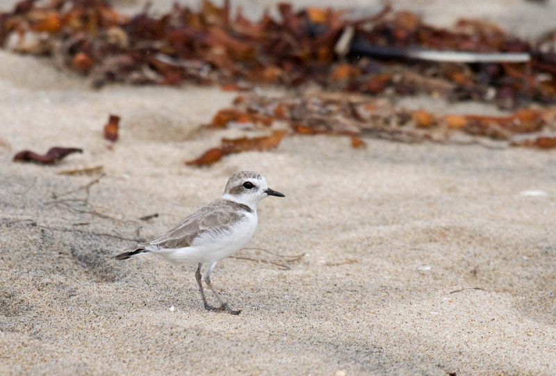
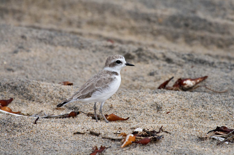
Snowy Plover. Imperial Beach, California. October 5, 2015. Greg Gillson.
Snowy Plover

Endangered Snowy Plovers and Least Terns nest on the open sandy beaches where they compete with sunbathers, surfers, dogs, and some vehicles. Nesting areas are roped off in summer, but that doesn't necessarily keep people out and nests from being trampled. Additionally, though camouflaged to match the dry sand, the tasty eggs and chicks are under constant siege from gulls, crows, raccoons, and other predators. If these cute, tiny shorebirds lay belly-down on the sand and don't move, they just might go unnoticed by predators.

Snowy Plover

Snowy Plover

Saturday, July 18, 2015

Summer Tanager and Brown-crested Flycatcher at Scissors Crossing

It took two days, but I finally found my primary target bird. I left the Inn in Julian each morning before dawn to drive 20 minutes over the winding mountain road to arrive at this desert creek bed at sunrise. After a couple of hours on the second day--there it is! Summer Tanager!

Summer Tanager
Summer Tanager
Summer Tanager in cottonwoods. San Felipe Rd, San Diego Co., California. July 5, 2015. Greg Gillson.
First discovered breeding here in 1998, Scissors Crossing contains the most nesting pairs of Summer Tanagers in San Diego County (up to 8 pairs in 2002). A few other nesting pairs have been discovered scattered about the county, but none are as regular. A few Summer Tanagers winter annually as vagrants in San Diego in ornamental shrubs along the coast. But these are the slightly smaller Eastern form with a smaller bill.

Scissors Crossing is a long ways from anywhere--especially when you want to arrive at sunrise, or before. It is 70 miles from San Diego, 50 miles from Escondido, on winding mountain roads, for the most part.


The exact birding location is north 1/2 mile on San Felipe Road [S2] from the intersection of CA-78. If you type it into your map app on your mobile phone it is: 21456 San Felipe Rd, Julian, California 92036. Really, though, it is 12.6 miles east of Julian, and takes about 22 minutes down the winding mountain road of CA-78 from Julian (at 4000 feet elevation). There aren't any public facilities nearby--no gas, food, drinks, restrooms. The only nearby homes are south back across highway CA-78 on S2 about 2 miles to the small unincorporated community of Shelter Valley (which does have a fire department and community center). It is 20 miles to Borrego Springs, on flatter roads and highway speeds.

Looking West across San Felipe Creek
Looking south across San Felipe Creek.
The first day I was there, July 4th, it was hot--88 degrees at dawn--and windy. The second day, July 5th, it was a wonderful 72 degrees and calm. That made hearing birds much easier the second day. For instance, the second day there were several singing Bell's Vireos in the river bottom woods. The first day I detected none.

Looking Southeast along San Felipe Creek
Looking southeast along San Felipe Road. The tall cottonwoods on the left are where you bird the (dry) creek.
My second target species came before the Summer Tanager. But actually identifying them was much harder and took more work.

There were about a dozen Ash-throated Flycatchers flying around the area, both in the desert scrub and in the cottonwoods and mesquite trees in the dry creek bed. On both days, about two hours after sunrise, a group of 3 or 4 Brown-crested Flycatchers started making racket high in the cottonwoods. Their calls were louder, liquid, and less harsh, but similar. And visually, they were almost identical, the Brown-crested with a slightly larger bill, yellower belly, and a hard-to-see slightly different pattern to the rust on the tip of the tail (rust reaching all the way to the end). Brown-crested Flycatchers are rare breeders here and at Borrego Springs, starting in 2000.

Brown-crested Flycatcher
Brown-crested Flycatcher in mesquite. San Felipe Rd, San Diego Co., California. July 4, 2015. Greg Gillson.
Okay, here's the deal. The creek bed and trees are fenced off. You have to park on the side of the road and watch (and listen) from there. There is really only one place to get close enough to the cottonwoods to see and hear these birds. Park off the road on the wide shoulder on the curve under the shade of a mesquite tree. Bird from there. The first day I parked at the San Felipe Monument. It is the little loop on the side of the road you can see on the left side of the satellite photo below. Then I birded along the road a half mile to the marked corner and the curve just beyond. The second day I stayed quite close to the marked area and saw and heard more birds (no doubt aided by calm winds).

Birding at Scissors Crossing
Birding at Scissors Crossing. Park where indicated.
My eBird list for July 4th.

My eBird list for July 5th.

When should you look?
Summer Tanager: May through August
Brown-crested Flycatcher: late May into August

Monday, June 29, 2015

Lesser Nighthawks on Rangeland Road

Nancy Christensen reported at least 30 Lesser Nighthawks at dusk on Rangeland Road, near the Ramona Grasslands Preserve (site guide here) on June 25 and 26, 2015. I had not yet seen this species in San Diego County. So I drove out the evening of June 27 to see for myself. I went early because she had also reported Grasshopper Sparrows and Cattle Egrets--not rare, but they had eluded me so far this year.

I arrived on Rangeland road at 7:26 pm. It was overcast and muggy, about 81F. The first bird was a singing Blue Grosbeak on the fence line which then flew across Highland Valley Rd and into a lone oak. Scanning westward I noted 3 Cattle Egrets flying northward over the fields. I drove about 1/2 mile north, past two other cars full of birders waiting on the top of the hill east of the Ramona Water District reclamation pond (18022 Rangeland Rd, Ramona, CA 92065). Unfortunately, the nearby pond is not visible from the road.

Just beyond this, at the bottom of the rise, I stopped next to a longer-grass field, near a riparian area. It looked good for Grasshopper Sparrows, but I heard none. I could hear birds at the hidden pond--Great-tailed Grackles and Killdeer. Four White-faced Ibis flew north away from the pond. Three Black-necked Stilts flew in and descended into the pond area.

Right at sunset, however, (8:01 pm) two bird species became active. Some sparrow movement in the grass for the past few minutes finally gave a weak, barely audible, insect-like chirp-trill: Grasshopper Sparrows! And, over the ponds a couple of Lesser Nighthawks began flying around!

I had fortuitously positioned myself with a view of the sky above both the hidden pond to the SW and the other pond NW, visible westward from the end of Rangeland Rd. Since I was looking toward the setting sun, through clouds, the conditions were good for looking for silhouettes of flying nighthawks against the dimming sky.

Scanning and counting over both ponds, I reached the peak count about 8:15 pm. Off over the northwest pond a half mile were a maximum of 23 Lesser Nighthawks. Over the near pond, less than a quarter of a mile to the WSW I counted a maximum of 30 nighthawks in a continuous sweep of the skies with my binoculars. By 8:20 pm it was too dark to see nighthawks in the sky. The nighthawk show was over. But the Grasshopper Sparrows were now singing continuously in the near-dark.

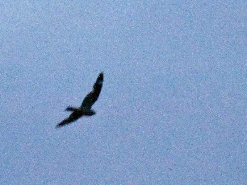
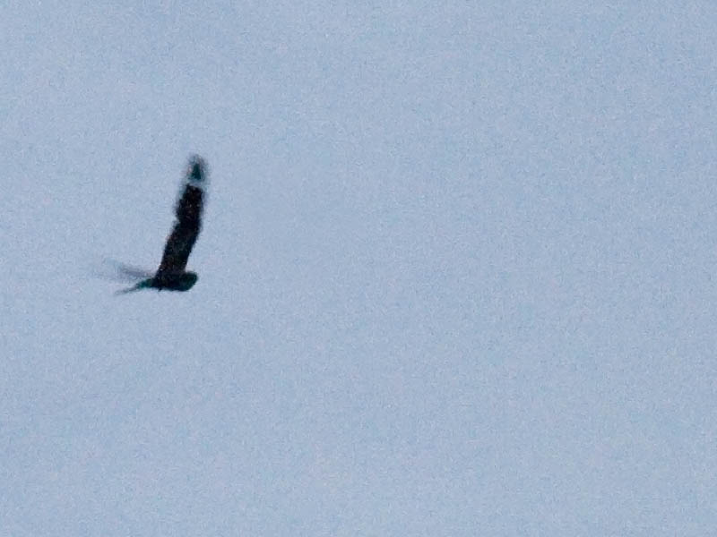
I attempted photos of some of the nearest nighthawks, but it was just too dark for the camera to provide sharp pictures. Below, on photos I brightened, you can see the large head and crop, longer notched tail, long wings with a bend at the wrist that is held forward, slightly rounded wing tips, and a white wing patch just back from the tips.

Lesser Nighthawk at dusk
Lesser Nighthawk at dusk. Ramona, California. June 27, 2015. Greg Gillson.
These 53 birds are the second highest count of Lesser Nighthawks recorded for San Diego County, at least, up to 1999 (San Diego County Bird Atlas, Philip Unitt, 2004).

Additionally, for being so many summering birds, this comes from an area without previous local sightings of Lesser Nighthawks! Does that mean they were here all along, unseen? Or is this a new area for them? You can bet birders are going to return next year to see if they are here again.

Lesser Nighthawk at dusk

John Bruin's eBird checklist from June 27, 2015 with photos of nighthawks.

Nancy Christenen's eBird checklist from June 26, 2015 with photos of nighthawks.

Sunday, June 14, 2015

Finding Gray Vireos on Kitchen Creek Road

From San Diego at sea level it is 54 miles east on Interstate 8 to Laguna Summit at just over 4000 feet. Now exit at Hwy 8 mile marker 54 on Kitchen Creek Road and it is 2.5 miles to the Pacific Crest Trail (PCT) parking area. This is the most reliable spot in San Diego County, indeed all of California, for finding Gray Vireos.

After living in San Diego County now for 21 months, I finally made the rather long trip (80 miles, 1 hour and 20 minutes from home) specifically to see this bird. 

Pacific Crest Trail on Kitchen Creek

On June 14, 2015 I rose at 4:30 a.m. and left home in San Marcos a bit after 5:00 a.m. I filled with gas then headed south on the 15 to the 8 and up, up, up. The June Gloom overcast stayed with me until I neared Pine Valley at about 3000 feet elevation. Then the newly risen sun shown directly in my eyes as I continued east. I arrived at the Pacific Crest Trail pullout at 6:30 a.m. and it was very birdy. In fact, I found 28 species here over the next 2 hours, as the temperature steadily climbed from 60F to 90F.

Map to Kitchen Creek Road

Within 15 minutes of arrival, between 500 and 1000 feet west on the PCT (Southbound) I heard my target species. There were 2 singing Gray Vireos and I photographed one of them at quite a distance up the hillside.

The bird was rather all-over gray. The under tail coverts and lower belly whiter. There was a thin white eye ring and a single faint wing bar.

Gray Vireo
Gray Vireo. Kitchen Creek, Pacific Crest Trail, San Diego County, California. June 14, 2015. Greg Gillson.
My 300th San Diego County bird!
The voice was a loud repeated series of 4 well-spaced sweet sliding whistles, one slightly buzzy, one higher: "suweet,  dzuwee, suweet, suwee." It sounded quite similar to Cassin's Vireo.

Compared to surrounding areas that don't seem to have Gray Vireos, the chaparral here is thicker and taller, interspersed with more boulders, and in a steeper canyon. There was a little creek down a couple hundred feet, but the vireo was up in the dry chaparral.

Looking down on Kitchen Creek
Chaparral was composed of dozens of species of large shrubs, smaller shrubs and flowers. Some I saw and think I may have identified correctly (guessed by picture-matching) using this website are: Big Berry Manzanita, Common Sagebrush, Golden Bowl Mariposa, Indian Paintbrush, Fringed Spineflower, Yucca, Toyon, Cholla, Chamas. Here is another page on common plants and animals of California's chaparral.

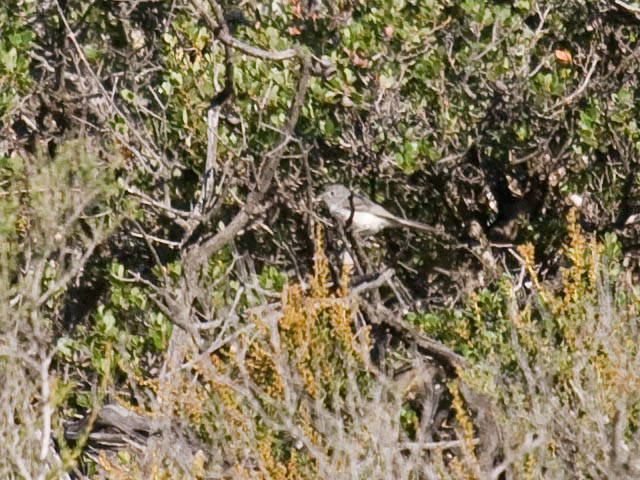
Wrentit
Wrentit
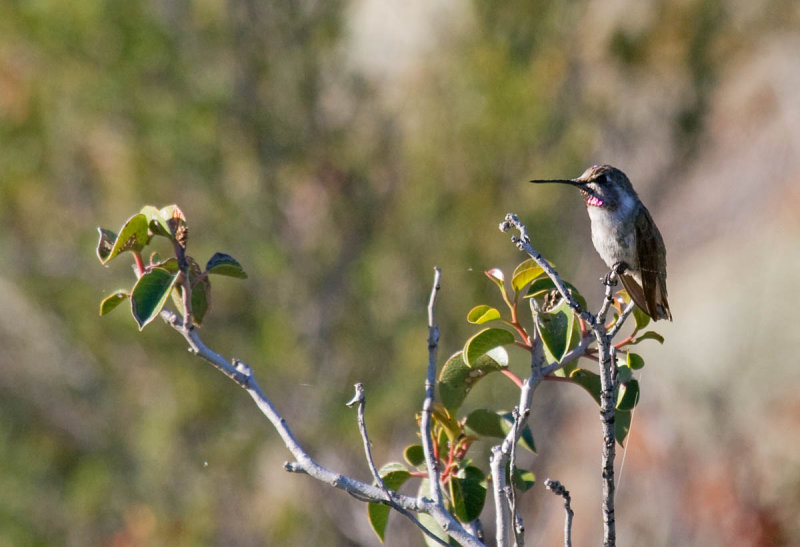
Typical birds included Wrentit, California Thrasher, Bewick's Wren, Spotted Towhee, California Towhee, Costa's Hummingbird, Ash-throated Flycatcher, and Black-chinned Sparrow. A Mountain Quail squawked once early.

Costa's Hummingbird
Costa's Hummingbird
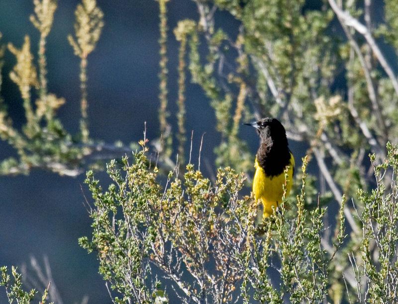
One bird here that I rarely see is Scott's Oriole. It sings like a Western Meadowlark... or maybe like two meadowlarks harmonizing together--such a rich bright song coming from a dry, dull landscape.

Scott's Oriole
Scott's Oriole
Way down on the creek I saw a couple of California Quail and some Lawrence's Goldfinches. The calls of both Rock and Canyon Wrens echoed down the canyon. Not really the best habitat--a Cactus Wren chugged away across the canyon, unseen. That made 5 wren species within a quarter mile!

Black-headed Grosbeak
Birds of Kitchen Creek Road are on this hotspot list from eBird. It includes 143 species from the first 5 miles, from Interstate 8 to the gate.

Horned Lizard
Horned Lizard
At mile post 4.5 on Kitchen Creek Road is Cibbets Flat Campground. The oaks here add Oak Titmouse, White-breasted Nuthatch, Western Bluebird, House Wren, Acorn Woodpecker, Nuttall's Woodpecker, Black-chinned Hummingbird, Western Wood-Pewee, Lawrence's and Lesser Goldfinch, and Steller's Jays to the other chaparral birds.

Oak Titmouse
Oak Titmouse at Cibbets Flat Campground
Acorn Woodpecker
Acorn Woodpecker at Cibbets Flat Campground.